Area Overview for NG17 8RL
Photos of NG17 8RL

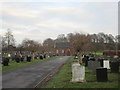
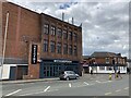
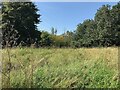

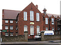


21 photos from this area
Area Information
Key information about the NG17 8RL including its size, population, and administrative classification.
- Area Type
- Postcode
- Area Size
- 4.4 hectares
- Population
- 2318
- Population Density
- 586 people/km²
House Prices in NG17 8RL
100
Properties
£189,624
Average Sold Price
£70,000
Lowest Price
£427,000
Highest Price
Showing 100 properties
| Address | Type | Beds | Baths | Last Sale Price | Last Sale Date | |
|---|---|---|---|---|---|---|
| 134 Hornbeam Way, Kirkby In Ashfield, NG17 8RL | Semi-detached | 3 | 2 | £210,000 | Nov 2025 | |
| 46 Hornbeam Way, Kirkby In Ashfield, NG17 8RL | house | 3 | 2 | £210,000 | Jun 2025 | |
| 47 Hornbeam Way, Kirkby In Ashfield, NG17 8RL | Terraced | 3 | 1 | £155,000 | May 2025 | |
| 52 Hornbeam Way, Kirkby In Ashfield, NG17 8RL | Terraced | 3 | - | £205,000 | Sep 2024 | |
| 29 Hornbeam Way, Kirkby In Ashfield, NG17 8RL | Flat | 2 | 1 | £118,500 | Jun 2023 | |
| 94 Hornbeam Way, Kirkby In Ashfield, NG17 8RL | house | - | - | £320,000 | Nov 2022 | |
| 41 Hornbeam Way, Kirkby In Ashfield, NG17 8RL | house | 5 | 4 | £363,000 | Aug 2022 | |
| 28 Hornbeam Way, Kirkby In Ashfield, NG17 8RL | Terraced | 3 | 2 | £195,000 | Aug 2022 | |
| 56 Hornbeam Way, Kirkby In Ashfield, NG17 8RL | Terraced | 4 | 3 | £195,000 | Apr 2022 | |
| 96 Hornbeam Way, Kirkby In Ashfield, NG17 8RL | house | 4 | 3 | £265,000 | Apr 2022 |
Page 1 of 10
Energy Efficiency in NG17 8RL
Amenities
Schools
| Rank | School | Type | Entry gender | Ages |
|---|
Explore more schools in this area
Go to Schools tabDemographics
Household Size
Two person
most common
Accommodation Type
Houses
most common
Tenure
69
majority
Ethnic Group
White
most common
Religion
N/A
most common
Household Composition
N/A
most common
Age
47
median
Adults (30-64 years)
most common
Household Deprivation
N/A
with no deprivation
NS-SEC
25
in Lower managerial occupations
Explore more demographic insights in this area
Go to Demographics tabPlanning
Planning Constraints
- Flood RiskPremium
- Ramsar Wetland SitesPremium
- Area of Outstanding Natural BeautyPremium
- Protected Nature ReservePremium
- Protected WoodlandPremium