Area Overview for NG17 8EE
Photos of NG17 8EE
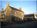
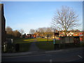
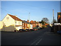
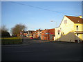
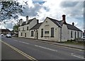
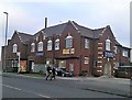
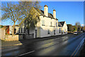
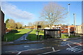
50 photos from this area
Area Information
Key information about the NG17 8EE including its size, population, and administrative classification.
- Area Type
- Postcode
- Area Size
- 1.4 hectares
- Population
- 1289
- Population Density
- 7981 people/km²
House Prices in NG17 8EE
50
Properties
£70,929
Average Sold Price
£23,500
Lowest Price
£129,000
Highest Price
Showing 50 properties
| Address | Type | Beds | Baths | Last Sale Price | Last Sale Date | |
|---|---|---|---|---|---|---|
| 19 Vernon Road, Kirkby In Ashfield, NG17 8EE | house | - | - | £110,000 | Sep 2023 | |
| 91 Vernon Road, Kirkby In Ashfield, NG17 8EE | Terraced | 2 | 1 | £100,000 | Aug 2023 | |
| 61 Vernon Road, Kirkby In Ashfield, NG17 8EE | house | - | - | £75,000 | Aug 2023 | |
| 93 Vernon Road, Kirkby In Ashfield, NG17 8EE | house | 2 | 1 | £98,000 | Jul 2023 | |
| 81 Vernon Road, Kirkby In Ashfield, NG17 8EE | Terraced | 2 | 1 | £95,000 | Jun 2023 | |
| 67 Vernon Road, Kirkby In Ashfield, NG17 8EE | Terraced | 2 | 1 | £74,500 | Apr 2023 | |
| 89 Vernon Road, Kirkby In Ashfield, NG17 8EE | Terraced | 2 | 1 | £113,500 | Oct 2022 | |
| 27 Vernon Road, Kirkby In Ashfield, NG17 8EE | Terraced | 2 | 1 | £95,000 | Jun 2022 | |
| 65 Vernon Road, Kirkby In Ashfield, NG17 8EE | Terraced | 2 | 1 | £97,500 | Apr 2022 | |
| 41 Vernon Road, Kirkby In Ashfield, NG17 8EE | house | - | - | £86,000 | Feb 2022 |
Page 1 of 5
Energy Efficiency in NG17 8EE
Amenities
Schools
| Rank | School | Type | Entry gender | Ages |
|---|
Explore more schools in this area
Go to Schools tabDemographics
Household Size
Family (3-5 people)
most common
Accommodation Type
Houses
most common
Tenure
56
majority
Ethnic Group
White
most common
Religion
N/A
most common
Household Composition
N/A
most common
Age
47
median
Adults (30-64 years)
most common
Household Deprivation
N/A
with no deprivation
NS-SEC
17
in Lower managerial occupations
Explore more demographic insights in this area
Go to Demographics tabPlanning
Planning Constraints
- Flood RiskPremium
- Ramsar Wetland SitesPremium
- Area of Outstanding Natural BeautyPremium
- Protected Nature ReservePremium
- Protected WoodlandPremium