Area Overview for NG17 7HF
Photos of NG17 7HF
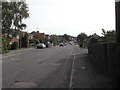
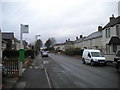
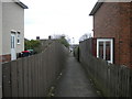
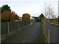
8 photos from this area
Area Information
Key information about the NG17 7HF including its size, population, and administrative classification.
- Area Type
- Postcode
- Area Size
- 3.9 hectares
- Population
- 1624
- Population Density
- 1467 people/km²
House Prices in NG17 7HF
42
Properties
£85,667
Average Sold Price
£27,000
Lowest Price
£165,000
Highest Price
Showing 42 properties
| Address | Type | Beds | Baths | Last Sale Price | Last Sale Date | |
|---|---|---|---|---|---|---|
| 34 Farm View Road, Kirkby In Ashfield, NG17 7HF | Semi-detached | 3 | 1 | £165,000 | Feb 2022 | |
| 15 Farm View Road, Kirkby In Ashfield, NG17 7HF | house | - | - | £120,000 | May 2021 | |
| 2 Farm View Road, Kirkby In Ashfield, NG17 7HF | Semi-detached | 3 | 1 | £95,000 | Dec 2019 | |
| 12 Farm View Road, Kirkby In Ashfield, NG17 7HF | Detached | 3 | 2 | £94,500 | Mar 2016 | |
| Martins Travel, 21 Farm View Road, Kirkby In Ashfield, NG17 7HF | Semi-detached | 3 | 1 | £83,000 | Jan 2015 | |
| 23 Farm View Road, Kirkby In Ashfield, NG17 7HF | Semi-detached | - | - | £77,000 | Oct 2007 | |
| 10 Farm View Road, Kirkby In Ashfield, NG17 7HF | Semi-detached | - | - | £80,000 | Nov 2006 | |
| 5 Farm View Road, Kirkby In Ashfield, NG17 7HF | Semi-detached | - | - | £27,000 | Dec 1998 | |
| 43 Farm View Road, Kirkby In Ashfield, NG17 7HF | house | - | - | £29,500 | Jul 1998 | |
| 6 Farm View Road, Kirkby In Ashfield, NG17 7HF | Detached | 3 | 1 | - | - |
Page 1 of 5
Energy Efficiency in NG17 7HF
Amenities
Schools
| Rank | School | Type | Entry gender | Ages |
|---|
Explore more schools in this area
Go to Schools tabDemographics
Household Size
Family (3-5 people)
most common
Accommodation Type
Houses
most common
Tenure
37
majority
Ethnic Group
White
most common
Religion
N/A
most common
Household Composition
N/A
most common
Age
47
median
Adults (30-64 years)
most common
Household Deprivation
N/A
with no deprivation
NS-SEC
12
in Lower managerial occupations
Explore more demographic insights in this area
Go to Demographics tabPlanning
Planning Constraints
- Flood RiskPremium
- Ramsar Wetland SitesPremium
- Area of Outstanding Natural BeautyPremium
- Protected Nature ReservePremium
- Protected WoodlandPremium