Area Overview for NG17 7EE
Photos of NG17 7EE

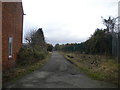
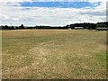
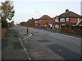
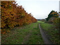

15 photos from this area
Area Information
Key information about the NG17 7EE including its size, population, and administrative classification.
- Area Type
- Postcode
- Area Size
- 1.3 hectares
- Population
- 1449
- Population Density
- 3264 people/km²
House Prices in NG17 7EE
34
Properties
£107,685
Average Sold Price
£34,000
Lowest Price
£319,995
Highest Price
Showing 34 properties
| Address | Type | Beds | Baths | Last Sale Price | Last Sale Date | |
|---|---|---|---|---|---|---|
| 57 Oxford Street, Kirkby In Ashfield, NG17 7EE | Bungalow | 3 | 2 | £319,995 | Feb 2024 | |
| 3 Oxford Street, Kirkby In Ashfield, NG17 7EE | house | - | - | £90,000 | Mar 2021 | |
| 27 Oxford Street, Kirkby In Ashfield, NG17 7EE | Semi-detached | 2 | - | £102,000 | Aug 2020 | |
| 55 Oxford Street, Kirkby In Ashfield, NG17 7EE | Bungalow | - | - | £135,000 | May 2019 | |
| 63 Oxford Street, Kirkby In Ashfield, NG17 7EE | Detached | 4 | 2 | £232,000 | Nov 2018 | |
| 17 Oxford Street, Kirkby In Ashfield, NG17 7EE | Semi-detached | 2 | 1 | £97,500 | Jul 2018 | |
| 21 Oxford Street, Kirkby In Ashfield, NG17 7EE | Semi-detached | 3 | 1 | £90,000 | Jul 2017 | |
| 19 Oxford Street, Kirkby In Ashfield, NG17 7EE | Semi-detached | 2 | 1 | £86,000 | Jan 2017 | |
| 15 Oxford Street, Kirkby In Ashfield, NG17 7EE | house | - | - | £79,000 | May 2015 | |
| 61 Oxford Street, Kirkby In Ashfield, NG17 7EE | Bungalow | 2 | - | £135,000 | Sep 2014 |
Page 1 of 4
Energy Efficiency in NG17 7EE
Amenities
Schools
| Rank | School | Type | Entry gender | Ages |
|---|
Explore more schools in this area
Go to Schools tabDemographics
Household Size
Two person
most common
Accommodation Type
Houses
most common
Tenure
78
majority
Ethnic Group
White
most common
Religion
N/A
most common
Household Composition
N/A
most common
Age
47
median
Adults (30-64 years)
most common
Household Deprivation
N/A
with no deprivation
NS-SEC
20
in Lower managerial occupations
Explore more demographic insights in this area
Go to Demographics tabPlanning
Planning Constraints
- Flood RiskPremium
- Ramsar Wetland SitesPremium
- Area of Outstanding Natural BeautyPremium
- Protected Nature ReservePremium
- Protected WoodlandPremium