Area Overview for NG17 7AW
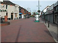
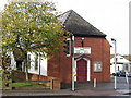
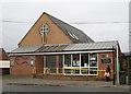
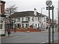
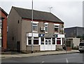
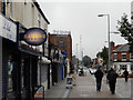
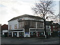
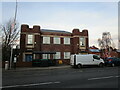
Photos of NG17 7AW


Area Information
Living in NG17 7AW offers a specific residential experience defined by its small scale and established character. This postcode area serves as a compact cluster for 1,843 residents, creating an intimate community feel within the Ashfield district. The setting provides a quiet alternative to larger urban centres while maintaining access to essential local services. You will find yourself in an environment where neighbours are likely to know one another, fostering a sense of mutual familiarity. The area consists primarily of houses, which contributes to a suburban atmosphere distinct from high-density developments. Daily life here revolves around practical convenience rather than the bustle of a major city. Residents enjoy a straightforward routine with nearby shops and transport links supporting their weekly needs. The small population size means that the immediate locality remains manageable without the overwhelming atmosphere of a large town. This area suits those seeking a grounded lifestyle where the focus is on the property and the immediate surroundings rather than expansive amenities found elsewhere. The cluster nature of this postcode ensures that everyone has access to the same local facilities while living in a closely knit group of homes.
- Area Type
- Postcode
- Area Size
- Not available
- Population
- 1843
- Population Density
- 2862 people/km²
The property market in NG17 7AW is characterised by a housing stock dominated by houses. With 43% of the population owning their homes, the area leans towards owner-occupation rather than a rental-heavy market. This specific percentage indicates that nearly half of the households have secured their properties, suggesting a degree of financial stability among residents. The predominant accommodation type throughout the postcode is houses, which limits the availability of flats or terraced options for some buyers. You should anticipate finding a range of household sizes, but the physical structure of the homes remains consistent with suburban regulations. This mix means that the market is not as fluid as in high-density urban zones but maintains steady demand from families seeking space. The relatively small population of 1,843 implies a slower turnover rate compared to larger postcodes, which can sometimes benefit existing owners but may reduce inventory for prospective buyers looking quickly. The area serves as a clear snapshot of semi-rural residential demand where larger dwellings prevail. Understanding that 43% of residents are homeowners helps you gauge the competitive nature of purchasing, especially if you are a first-time buyer looking at the limited stock of houses in this cluster.
House Prices in NG17 7AW
No properties found in this postcode.
Energy Efficiency in NG17 7AW
Residents of NG17 7AW enjoy a practical selection of amenities within a short travel distance. Your immediate reach includes five notable retail outlets, specifically Morrisons Daily Kirby, Morrisons East Kirkby in Ashfield Kirkby in, and Aldi West Kirkby in Ashfield Kirkby in. These supermarkets provide full groceries and daily essentials without the need for extended travel. Beyond shopping, you have access to five railway stations, including Kirkby in Ashfield Railway Station, Sutton Parkway Railway Station, and Newstead Railway Station. This rail connectivity links you directly to wider regional transport networks for commuting and holidays. Additionally, the Butler's Hill Tram Stop serves as a single metro connection nearby, offering an alternative public transport option for local journeys. This blend of retail density and multiple transport hubs creates a self-contained lifestyle where daily tasks are manageable. You can purchase meals, fresh produce, and general goods from local branches rather than venturing into city centres. The presence of these specific venues means your weekly shopping fits easily into a short drive or bus ride.
Amenities
Schools
Families considering NG17 7AW have access to two specific educational institutions within practical reach. Morven Park Primary and Nursery School operates as a primary school and holds an Ofsted rating of good. This established institution provides education for younger children and offers a nursery facility as well, allowing families to access early years provision on the same site. Kirkby Nursery Centre is the other nearby option, specialising in nursery-level care for infants. The combination of a rated primary school and a dedicated nursery centre addresses the needs of young families well within the community. You will find that schooling options are limited to these two named providers in the immediate vicinity, which suggests a focus on local retention rather than catchment areas extending far beyond the postcode. The presence of a primary school with a good rating provides reassurance for parents prioritising educational quality. The mix of early years and primary education means that most families can manage their children's schooling without needing to look further afield for the crucial first years of education.
| Rank | School | Type | Entry gender | Ages |
|---|---|---|---|---|
| 1 | Kirkby Nursery Centre | nursery | N/A | N/A |
| 2 | Morven Park Primary and Nursery School | primary | N/A | N/A |
Explore more schools in this area
Go to Schools tabDemographics
The community in NG17 7AW reflects a mature and stable demographic profile. The median age of residents is 47, indicating that the area attracts adults and established families rather than young students or empty nesters. Approximately 43% of households own their homes, a figure that suggests significant stability and long-term investment in the locality. You will encounter a population predominantly composed of White residents, with the majority falling into the 30 to 64-year-old age bracket. This dominance of middle-aged adults shapes the social rhythm of the neighbourhood, often resulting in quieter evenings and adult-oriented community events. The specific accommodation type of the area is houses, which aligns with the preference of the predominant age group for detached or semi-detached living spaces. Home ownership rates are moderate, implying a mix of long-standing families and some long-term residents who have not yet purchased, though the low heritage rate might indicate certain properties are still in family hands. The demographic consistency means you can expect a familiar range of social activities and community organisations catering to adults and older children. This balance of homeownership and age creates a predictable environment for those considering applying to live in this specific code.
Household Size
Accommodation Type
Tenure
Ethnic Group
Religion
Household Composition
Age
Household Deprivation
NS-SEC
Explore more demographic insights in this area
Go to Demographics tabPlanning
Planning Constraints
- Flood RiskPremium
- Ramsar Wetland SitesPremium
- Area of Outstanding Natural BeautyPremium
- Protected Nature ReservePremium
- Protected WoodlandPremium
- Crime RiskPremium