Area Overview for NG17 5FS
Photos of NG17 5FS


Area Information
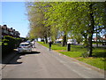
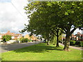
NG17 5FS is a small residential cluster located in Nottinghamshire, England. This specific postcode covers an area of just 6.1 hectares, creating a tightly knit neighbourhood rather than a sprawling suburb. The population stands at 1642 people, resulting in a density of 1110 people per square kilometre. You will find this environment suitable for those seeking a defined community rather than a vast urban expanse. Daily life here revolves around close proximity to neighbours within this compact footprint. The area functions as a distinct pocket within the wider local roads and transport network. Residents experience the benefits of a small-scale setting where routes are short and many householders know each other. You can expect a quiet existence without the scale of larger towns or cities. This postcode represents a specific slice of the Sutton in Ashfield landscape where housing plots are arranged efficiently. The size of the area ensures that planning decisions directly impact every home in NG17 5FS. Living here means being part of a group where neighbours live only a few metres from your own property. \section*{
- Area Type
- Postcode
- Area Size
- 6.1 hectares
- Population
- 1642
- Population Density
- 1110 people/km²
The property market in NG17 5FS is defined by traditional family homes rather than modern developments or rental conversions. Because 59% of residents are owner-occupiers, the area functions primarily as a market for semi-detached houses and family properties. You will find very few flats or apartments listed for sale within this specific postcode. The housing stock is overwhelmingly composed of standard houses built for family living. This strong home ownership percentage indicates a stable market with fewer short-term rentals than you might see in university towns. Buyers looking at NG17 5FS should expect to compete with locals who intend to stay for the long term. The accommodation type is exclusively houses, meaning the layout of the streets is designed for cars and driveways rather than shared corridors or lift access. Purchasing a home here aligns with the lifestyle of established families who value space and privacy. The lack of rental properties suggests that the local economy supports a workforce with sufficient income to buy property. If you are a first-time buyer, you will find that competition comes from experienced homeowners looking to upsize or downsize within this mature market. The density of 1110 people per square kilometre confirms that land is utilised efficiently, likely resulting in larger plots for these house types. This market dynamic offers security and predictability for those entering the property ladder in Nottinghamshire.
House Prices in NG17 5FS
Showing 4 properties
| Address | Type | Beds | Baths | Last Sale Price | Last Sale Date | |
|---|---|---|---|---|---|---|
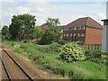
| Eviosys Packaging Aerosols Uk Ltd, Unit E, Oddicroft Lane, Sutton In Ashfield, NG17 5FS | Industrial | - | - | - | - | |
| Unit F2a, Oddicroft Lane, Sutton In Ashfield, NG17 5FS | Industrial | - | - | - | - | |
| Unit F1b Qualitex, Oddicroft Lane, Sutton In Ashfield, NG17 5FS | general_industrial | - | - | - | - | |
| Eviosys Packaging Aerosols Uk Ltd, Offices At, Unit E, Oddicroft Lane, Sutton In Ashfield, NG17 5FS | Industrial | - | - | - | - |
Energy Efficiency in NG17 5FS
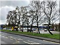
Daily life in NG17 5FS benefits from a selection of amenities within practical reach of residents. The nearest retail options include Aldi at Carsicestate Suttonin, a Lidl at Carsicestate Suttonin, and Heron at Carsicestate Suttonin. These supermarkets provide you with the essentials for grocery shopping, allowing you to bypass the need to drive to central Nottingham for weekly provisions. Rail transport is a cornerstone of your daily commute. You have access to five stations within easy reach, including Sutton Parkway Railway Station, Kirkby in Ashfield Railway Station, and Mansfield Railway Station. These stations connect you to national networks and local towns quickly. While larger leisure centres may be further away, your immediate neighbourhood supports standard shopping needs. The presence of major chains ensures that cooking, cleaning, and household maintenance costs are minimal. You do not need to travel far for general goods. Living in NG17 5FS offers a convenient balance between a quiet home and the availability of essential services. The concentration of retail near the estate means that even errands quick fits into your schedule without a long drive.
Amenities
Schools
| Rank | School | Type | Entry gender | Ages |
|---|
Explore more schools in this area
Go to Schools tabDemographics
The community in NG17 5FS reflects a mature population profile. The median age for residents is 47 years, indicating a neighbourhood dominated by long-term families and established households. Adults aged between 30 and 64 years represent the most common age range within this cluster. This demographic structure suggests stability and a focus on family life rather than single-person living or young professional rental neighbours. Home ownership is a central feature of daily life here. Nearly 60% of residents own their homes outright or have a mortgage, making this a predominantly owner-occupied sector. The remaining 41% rent their accommodation, but the majority of tenure is securely held by buyers. There are no rental-only streets or blocks in this postcode. Housing stock consists entirely of detached, semi-detached, or terraced houses. You will not find any apartments or flats within NG17 5FS, which aligns with the area's suburban character. The predominant ethnic group in the area is White, mirroring wider patterns for this specific part of Nottinghamshire. The combination of a high home ownership rate and a stable age profile creates a peaceful environment where long-term residents have shaped the local culture. This demographic makeup means you are likely to meet people who have lived in the area for decades, forging deep local connections and community support networks. The 59% ownership rate provides a clear indicator of financial stability within the neighbourhood.
Household Size
Accommodation Type
Tenure
Ethnic Group
Religion
Household Composition
Age
Household Deprivation
NS-SEC
Explore more demographic insights in this area
Go to Demographics tabPlanning
Planning Constraints
- Flood RiskPremium
- Ramsar Wetland SitesPremium
- Area of Outstanding Natural BeautyPremium
- Protected Nature ReservePremium
- Protected WoodlandPremium