Area Overview for NG17 5BW
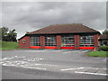
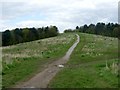
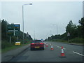
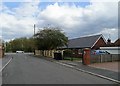
Photos of NG17 5BW


Area Information
Living in NG17 5BW offers a distinct residential experience within a small cluster where 1,538 people call this postcode home. This specific area functions as a tightly knit neighbourhood rather than a sprawling suburb, which creates an intimate sense of community for those seeking a quieter pace of life. The location presents itself primarily as a residential zone where daily routines revolve around proximity to local services and essential amenities. You can expect a setting that prioritises housing as its core function, separate from the direct hustle of major commercial districts yet connected via reliable transport links. The area's character is defined by its concentration of homes within a compact footprint, meaning you do not need to travel far to reach routine destinations. For prospective buyers looking for homes in NG17 5BW, the environment suggests a practical choice for families or individuals who value established residential pockets. The low population density contrasts with the strong connectivity to nearby transport hubs, allowing you to enjoy a slower local atmosphere while maintaining access to broader regional networks. This postcode represents a specific slice of the wider Mansfield and Sutton area, offering a defined sense of place without the anonymity of larger urban centres. Your time in this area centers on domestic life supported by a straightforward infrastructure.
- Area Type
- Postcode
- Area Size
- Not available
- Population
- 1538
- Population Density
- 4540 people/km²
The housing landscape in NG17 5BW is defined entirely by Houses, with no data on flat conversions or high-density apartment blocks present. This indicates a traditional suburban or village-style housing stock where space and single-family units are the norm. The home ownership rate stands at 35%, a figure that is notably lower than the national average for many suburban clusters. This statistic suggests that while you will find many permanent residents, a substantial portion of the population lives in the rental sector. For buyers searching for homes in NG17 5BW, this dynamic means the market balances between private sellers and landlord inventories. The 1538 population within this postcode covers a small residential cluster, so the total number of available properties is inherently limited compared to larger urban districts. You are not looking at a developer-led new-build area but rather at an established stock of traditional housing. The exclusive presence of Houses means that floor plans will typically involve gardens, driveways, and single dwellings, catering to families who require private outdoor space rather than urban compact living. This profile creates a specific market segment where you are purchasing a standalone asset within a tight-knit environment. The relatively low ownership rate implies active property movement, ensuring that inventory remains available for those ready to transact, though specific price brackets depend on the current regional market conditions for a 1538-resident area.
House Prices in NG17 5BW
No properties found in this postcode.
Energy Efficiency in NG17 5BW
Daily life in NG17 5BW is supported by a practical selection of amenities located within practical reach. You have access to five retail outlets, including Aldi Carsic Estate Sutton in, Lidl Carsic Estateestate Sutton in, and Heron Carsic Estate Sutton in. These supermarkets and retailers ensure that food shopping and household necessities are available without a long drive. Residents can manage their weekly provisions locally, integrating these stores into a sustainable routine. Transport connectivity is equally convenient, with five rail stations identified as accessible points. Sutton Parkway Railway Station, Kirkby in Ashfield Railway Station, and Mansfield Railway Station are key hubs that link you to wider travel networks. These stations provide straightforward access to Mansfield and Sutton, allowing you to reach larger commercial centres for leisure, dining, or further shopping when required. The presence of these specific railheads means you do not need to own a car for every journey, offering flexibility for trips to the mainline. This combination of local retail and nearby railway access creates a lifestyle where convenience is balanced with local charm. You can enjoy the peace of residential housing while having the option to visit major supermarkets and train stations easily. The amenities named provide a self-sufficient base for living in NG17 5BW, supporting a life that blends local independence with regional connectivity.
Amenities
Schools
Families moving to NG17 5BW will find a dedicated educational option in the form of Leamington Primary and Nursery School. This primary institution serves as a key local facility for young children within the cluster. Furthermore, Leamington Primary and Nursery Academy operates in the vicinity, with one entry in the local data explicitly rated as 'good' by Ofsted. The presence of both a School and an Academy with similar naming conventions suggests a structured educational framework where a primary phase is strongly represented in this immediate area. The school provision focuses squarely on primary education for residents of NG17 5BW. While secondary school details are not listed in the available records, the primary options provide essential early education. The 'good' rating for Leamington Primary and Nursery Academy offers a clear quality marker for homebuyers evaluating educational standards nearby. You can expect a local environment where young families are served by these specific institutions, ensuring that schooling needs are met without needing to commute to distant towns for the initial years of education. The consistency in school names indicates a well-established local provision tailored to the demographic needs of this 1538-person postcode area.
| Rank | School | Type | Entry gender | Ages |
|---|
Explore more schools in this area
Go to Schools tabDemographics
The community profile in NG17 5BW reflects a mature population, with a median age of 47 years. The most common age range consists of adults between 30 and 64 years, which forms the backbone of the local demographic. This concentration indicates an area where established households reside rather than transient young professionals or retiring pensioners moving in large numbers. The predominant ethnic group in this cluster is White, aligning with the broader historical demographic patterns of the region. Home ownership sits at 35% within this postcode, suggesting that roughly two-thirds of the residents do not own their homes outright. This figure points towards a significant rental sector or areas where younger adults or those on housing assistance rents are present. The accommodation type is exclusively Houses, meaning there are no apartments or flats registered within this specific data set. This uniformity in property style suggests a traditional housing stock typical of provincial towns, likely comprised of semi-detached or detached bungalows and family homes. The demographic stability, marked by a resident base aged mostly between 30 and 64, creates a community driven by the needs of families and working-age adults. You will find an environment where long-term residents are common, though the lower ownership rate means turnover and renting remain active features of the local landscape.
Household Size
Accommodation Type
Tenure
Ethnic Group
Religion
Household Composition
Age
Household Deprivation
NS-SEC
Explore more demographic insights in this area
Go to Demographics tabPlanning
Planning Constraints
- Flood RiskPremium
- Ramsar Wetland SitesPremium
- Area of Outstanding Natural BeautyPremium
- Protected Nature ReservePremium
- Protected WoodlandPremium