Area Overview for NG17 4NF
Photos of NG17 4NF


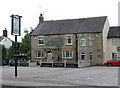

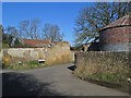


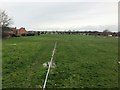
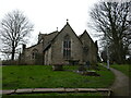


46 photos from this area
Area Information
Key information about the NG17 4NF including its size, population, and administrative classification.
- Area Type
- Postcode
- Area Size
- 1.7 hectares
- Population
- 1350
- Population Density
- 3162 people/km²
House Prices in NG17 4NF
39
Properties
£154,250
Average Sold Price
£46,000
Lowest Price
£308,000
Highest Price
Showing 39 properties
| Address | Type | Beds | Baths | Last Sale Price | Last Sale Date | |
|---|---|---|---|---|---|---|
| 94 Farndale Road, Sutton In Ashfield, NG17 4NF | Detached | 4 | 1 | £308,000 | Sep 2024 | |
| 80 Farndale Road, Sutton In Ashfield, NG17 4NF | Semi-detached | 3 | 1 | £210,000 | Nov 2023 | |
| 126 Farndale Road, Sutton In Ashfield, NG17 4NF | Bungalow | 3 | 1 | £151,500 | Mar 2023 | |
| 86 Farndale Road, Sutton In Ashfield, NG17 4NF | Semi-detached | 4 | 2 | £245,000 | Sep 2022 | |
| 124 Farndale Road, Sutton In Ashfield, NG17 4NF | Bungalow | 2 | 1 | £210,000 | Dec 2021 | |
| 112 Farndale Road, Sutton In Ashfield, NG17 4NF | Bungalow | 3 | 1 | £240,000 | Jun 2021 | |
| 104 Farndale Road, Sutton In Ashfield, NG17 4NF | Bungalow | - | - | £160,000 | Aug 2020 | |
| 120 Farndale Road, Sutton In Ashfield, NG17 4NF | Bungalow | 3 | 2 | £168,000 | Aug 2020 | |
| 68 Farndale Road, Sutton In Ashfield, NG17 4NF | Bungalow | 3 | 1 | £227,500 | Apr 2018 | |
| 106 Farndale Road, Sutton In Ashfield, NG17 4NF | Bungalow | 3 | - | £140,000 | Jun 2017 |
Page 1 of 4
Energy Efficiency in NG17 4NF
Amenities
Schools
| Rank | School | Type | Entry gender | Ages |
|---|
Explore more schools in this area
Go to Schools tabDemographics
Household Size
Two person
most common
Accommodation Type
Houses
most common
Tenure
88
majority
Ethnic Group
White
most common
Religion
N/A
most common
Household Composition
N/A
most common
Age
47
median
Adults (30-64 years)
most common
Household Deprivation
N/A
with no deprivation
NS-SEC
26
in Lower managerial occupations
Explore more demographic insights in this area
Go to Demographics tabPlanning
Planning Constraints
- Flood RiskPremium
- Ramsar Wetland SitesPremium
- Area of Outstanding Natural BeautyPremium
- Protected Nature ReservePremium
- Protected WoodlandPremium