Area Overview for NG17 4HG
Photos of NG17 4HG
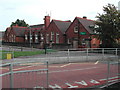
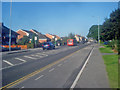
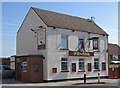
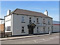
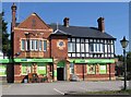
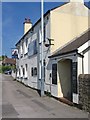

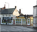
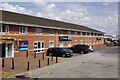
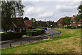
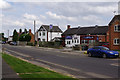
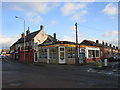
29 photos from this area
Area Information
Key information about the NG17 4HG including its size, population, and administrative classification.
- Area Type
- Postcode
- Area Size
- 2.6 hectares
- Population
- 2145
- Population Density
- 2555 people/km²
House Prices in NG17 4HG
40
Properties
£134,622
Average Sold Price
£36,500
Lowest Price
£248,000
Highest Price
Showing 40 properties
| Address | Type | Beds | Baths | Last Sale Price | Last Sale Date | |
|---|---|---|---|---|---|---|
| 283 Mansfield Road, Sutton In Ashfield, NG17 4HG | Semi-detached | 4 | 1 | £248,000 | Oct 2025 | |
| 241 Mansfield Road, Sutton In Ashfield, NG17 4HG | Semi-detached | 3 | 1 | £180,000 | May 2024 | |
| 245 Mansfield Road, Sutton In Ashfield, NG17 4HG | house | 3 | 1 | £179,000 | Oct 2022 | |
| 273 Mansfield Road, Sutton In Ashfield, NG17 4HG | house | - | - | £165,000 | Feb 2022 | |
| 171 Mansfield Road, Sutton In Ashfield, NG17 4HG | Bungalow | 2 | 1 | £145,000 | Jul 2021 | |
| 293 Mansfield Road, Sutton In Ashfield, NG17 4HG | house | - | - | £183,000 | May 2021 | |
| The Croft, 167A Mansfield Road, Sutton In Ashfield, NG17 4HG | Bungalow | 3 | 1 | £240,000 | Mar 2020 | |
| 287 Mansfield Road, Sutton In Ashfield, NG17 4HG | house | - | - | £155,000 | May 2017 | |
| 247 Mansfield Road, Sutton In Ashfield, NG17 4HG | Semi-detached | 3 | 1 | £120,000 | Oct 2016 | |
| 281 Mansfield Road, Sutton In Ashfield, NG17 4HG | Semi-detached | 4 | - | £122,000 | Aug 2014 |
Page 1 of 4
Energy Efficiency in NG17 4HG
Amenities
Schools
| Rank | School | Type | Entry gender | Ages |
|---|
Explore more schools in this area
Go to Schools tabDemographics
Household Size
Two person
most common
Accommodation Type
Houses
most common
Tenure
66
majority
Ethnic Group
White
most common
Religion
N/A
most common
Household Composition
N/A
most common
Age
47
median
Adults (30-64 years)
most common
Household Deprivation
N/A
with no deprivation
NS-SEC
26
in Lower managerial occupations
Explore more demographic insights in this area
Go to Demographics tabPlanning
Planning Constraints
- Flood RiskPremium
- Ramsar Wetland SitesPremium
- Area of Outstanding Natural BeautyPremium
- Protected Nature ReservePremium
- Protected WoodlandPremium