Area Overview for NG17 4EA
Photos of NG17 4EA
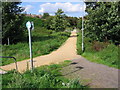
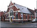
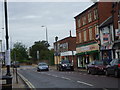
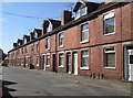
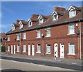

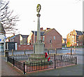
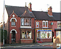
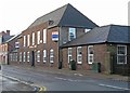
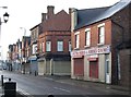
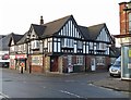
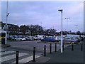
33 photos from this area
Area Information
Key information about the NG17 4EA including its size, population, and administrative classification.
- Area Type
- Postcode
- Area Size
- 9340 m²
- Population
- 1350
- Population Density
- 4701 people/km²
House Prices in NG17 4EA
22
Properties
£96,514
Average Sold Price
£38,000
Lowest Price
£195,000
Highest Price
Showing 22 properties
| Address | Type | Beds | Baths | Last Sale Price | Last Sale Date | |
|---|---|---|---|---|---|---|
| 131 Priestsic Road, Sutton In Ashfield, NG17 4EA | Terraced | 3 | 1 | £195,000 | Jun 2025 | |
| 129 Priestsic Road, Sutton In Ashfield, NG17 4EA | Terraced | 1 | 2 | £160,000 | Feb 2022 | |
| 109 Priestsic Road, Sutton In Ashfield, NG17 4EA | Semi-detached | 3 | 1 | £94,000 | Feb 2020 | |
| 127 Priestsic Road, Sutton In Ashfield, NG17 4EA | Terraced | 3 | 1 | £80,000 | May 2019 | |
| 117 Priestsic Road, Sutton In Ashfield, NG17 4EA | Semi-detached | 3 | 1 | £130,000 | Mar 2018 | |
| 95 Priestsic Road, Sutton In Ashfield, NG17 4EA | Detached | 3 | 1 | £130,000 | Oct 2015 | |
| 137 Priestsic Road, Sutton In Ashfield, NG17 4EA | Detached | - | - | £87,750 | Aug 2001 | |
| 133 Priestsic Road, Sutton In Ashfield, NG17 4EA | house | 3 | - | £55,950 | Oct 2000 | |
| 121 Priestsic Road, Sutton In Ashfield, NG17 4EA | Semi-detached | - | - | £38,000 | May 1999 | |
| 97 Priestsic Road, Sutton In Ashfield, NG17 4EA | Detached | 3 | 2 | £51,000 | Nov 1995 |
Page 1 of 3
Energy Efficiency in NG17 4EA
Amenities
Schools
| Rank | School | Type | Entry gender | Ages |
|---|
Explore more schools in this area
Go to Schools tabDemographics
Household Size
Two person
most common
Accommodation Type
Houses
most common
Tenure
82
majority
Ethnic Group
White
most common
Religion
N/A
most common
Household Composition
N/A
most common
Age
47
median
Adults (30-64 years)
most common
Household Deprivation
N/A
with no deprivation
NS-SEC
23
in Lower managerial occupations
Explore more demographic insights in this area
Go to Demographics tabPlanning
Planning Constraints
- Flood RiskPremium
- Ramsar Wetland SitesPremium
- Area of Outstanding Natural BeautyPremium
- Protected Nature ReservePremium
- Protected WoodlandPremium