Area Overview for NG17 4DS
Photos of NG17 4DS

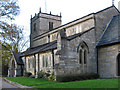
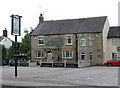

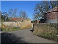
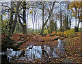
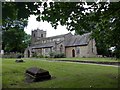
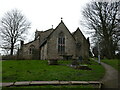
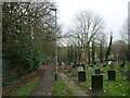
46 photos from this area
Area Information
Key information about the NG17 4DS including its size, population, and administrative classification.
- Area Type
- Postcode
- Area Size
- 4.4 hectares
- Population
- 1350
- Population Density
- 3162 people/km²
House Prices in NG17 4DS
33
Properties
£144,436
Average Sold Price
£43,000
Lowest Price
£430,000
Highest Price
Showing 33 properties
| Address | Type | Beds | Baths | Last Sale Price | Last Sale Date | |
|---|---|---|---|---|---|---|
| The Glens, 36 Quarrydale Avenue, Sutton In Ashfield, NG17 4DS | house | 4 | 2 | £430,000 | Dec 2023 | |
| 22 Quarrydale Avenue, Sutton In Ashfield, NG17 4DS | Semi-detached | 3 | 1 | £214,500 | Apr 2023 | |
| 4 Quarrydale Avenue, Sutton In Ashfield, NG17 4DS | Semi-detached | 3 | 1 | £205,000 | Apr 2023 | |
| 2 Quarrydale Avenue, Sutton In Ashfield, NG17 4DS | house | - | - | £145,000 | Oct 2021 | |
| 24 Quarrydale Avenue, Sutton In Ashfield, NG17 4DS | house | - | - | £120,000 | Sep 2021 | |
| 8 Quarrydale Avenue, Sutton In Ashfield, NG17 4DS | Semi-detached | 3 | 1 | £182,000 | Jul 2021 | |
| 29 Quarrydale Avenue, Sutton In Ashfield, NG17 4DS | house | - | - | £185,000 | Jun 2021 | |
| 20 Quarrydale Avenue, Sutton In Ashfield, NG17 4DS | house | - | - | £200,000 | Mar 2021 | |
| 18 Quarrydale Avenue, Sutton In Ashfield, NG17 4DS | Semi-detached | 3 | 1 | £157,500 | Mar 2019 | |
| 21 Quarrydale Avenue, Sutton In Ashfield, NG17 4DS | Detached | 3 | 1 | £178,000 | Oct 2017 |
Page 1 of 4
Energy Efficiency in NG17 4DS
Amenities
Schools
| Rank | School | Type | Entry gender | Ages |
|---|
Explore more schools in this area
Go to Schools tabDemographics
Household Size
Two person
most common
Accommodation Type
Houses
most common
Tenure
88
majority
Ethnic Group
White
most common
Religion
N/A
most common
Household Composition
N/A
most common
Age
47
median
Adults (30-64 years)
most common
Household Deprivation
N/A
with no deprivation
NS-SEC
26
in Lower managerial occupations
Explore more demographic insights in this area
Go to Demographics tabPlanning
Planning Constraints
- Flood RiskPremium
- Ramsar Wetland SitesPremium
- Area of Outstanding Natural BeautyPremium
- Protected Nature ReservePremium
- Protected WoodlandPremium