Area Overview for NG17 2SS
Photos of NG17 2SS
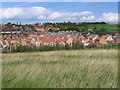
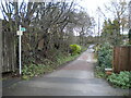
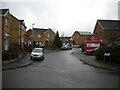
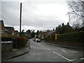
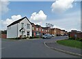
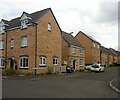
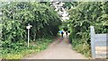

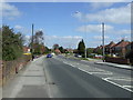

14 photos from this area
Area Information
Key information about the NG17 2SS including its size, population, and administrative classification.
- Area Type
- Postcode
- Area Size
- 1.2 hectares
- Population
- 1794
- Population Density
- 1201 people/km²
House Prices in NG17 2SS
41
Properties
£120,600
Average Sold Price
£51,050
Lowest Price
£230,000
Highest Price
Showing 41 properties
| Address | Type | Beds | Baths | Last Sale Price | Last Sale Date | |
|---|---|---|---|---|---|---|
| 33 New Hucknall Waye, Huthwaite, NG17 2SS | Detached | 3 | 1 | £190,000 | Mar 2025 | |
| 36 New Hucknall Waye, Huthwaite, NG17 2SS | Semi-detached | 3 | 1 | £190,000 | Feb 2025 | |
| 24 New Hucknall Waye, Huthwaite, NG17 2SS | Semi-detached | 3 | 1 | £174,000 | May 2022 | |
| 31 New Hucknall Waye, Huthwaite, NG17 2SS | Detached | 3 | 1 | £195,000 | Dec 2021 | |
| 17 New Hucknall Waye, Huthwaite, NG17 2SS | Detached | 3 | 1 | £230,000 | Jul 2021 | |
| 11 New Hucknall Waye, Huthwaite, NG17 2SS | Detached | 3 | 1 | £155,000 | Dec 2020 | |
| 32 New Hucknall Waye, Huthwaite, NG17 2SS | Detached | 3 | 1 | £140,000 | Jul 2020 | |
| 42 New Hucknall Waye, Huthwaite, NG17 2SS | Semi-detached | 3 | 1 | £123,000 | Feb 2020 | |
| 22 New Hucknall Waye, Huthwaite, NG17 2SS | Semi-detached | 3 | 1 | £118,000 | Jul 2019 | |
| 14 New Hucknall Waye, Huthwaite, NG17 2SS | Semi-detached | 2 | 1 | £104,000 | Jan 2019 |
Page 1 of 5
Energy Efficiency in NG17 2SS
Amenities
Schools
| Rank | School | Type | Entry gender | Ages |
|---|
Explore more schools in this area
Go to Schools tabDemographics
Household Size
Two person
most common
Accommodation Type
Houses
most common
Tenure
81
majority
Ethnic Group
White
most common
Religion
N/A
most common
Household Composition
N/A
most common
Age
47
median
Adults (30-64 years)
most common
Household Deprivation
N/A
with no deprivation
NS-SEC
26
in Lower managerial occupations
Explore more demographic insights in this area
Go to Demographics tabPlanning
Planning Constraints
- Flood RiskPremium
- Ramsar Wetland SitesPremium
- Area of Outstanding Natural BeautyPremium
- Protected Nature ReservePremium
- Protected WoodlandPremium