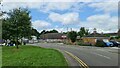
Area Overview for NG17 2HU
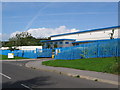
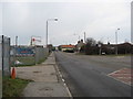
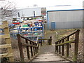
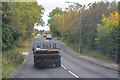
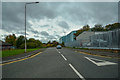
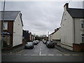
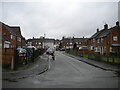
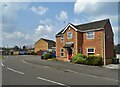
Photos of NG17 2HU
Area Information
Living in NG17 2HU offers a compact, residential experience shaped by its 23.9-hectare footprint and a population of 1,794 people. The area’s high density of 1,201 people per square kilometre suggests a tightly knit community, with homes clustered around local amenities. This postcode is primarily a family-oriented neighbourhood, with 81% of residents owning their homes and the majority of properties being houses. The median age of 47 indicates a mature population, with adults aged 30–64 forming the largest demographic group. Daily life here is anchored by nearby schools, retail outlets, and rail links, making it practical for families and commuters. While the area lacks expansive green spaces, its proximity to Sutton Parkway and Alfreton railway stations ensures easy access to broader regional networks. Digital connectivity is robust, with broadband scores near perfect, supporting remote work and online activities. However, the moderate crime risk means standard security measures are advisable. NG17 2HU balances convenience with a sense of stability, appealing to those seeking a quieter, established residential environment.
- Area Type
- Postcode
- Area Size
- 23.9 hectares
- Population
- 1794
- Population Density
- 1201 people/km²
The property market in NG17 2HU is dominated by owner-occupied homes, with 81% of residents owning their properties. This high rate of home ownership suggests a stable, long-term community with limited rental availability. The accommodation type is predominantly houses, which contrasts with areas where flats or apartments dominate. Given the area’s small size of 23.9 hectares, the housing stock is likely limited, making it a niche market for buyers seeking standalone properties. The compact nature of the postcode means that property seekers may need to look beyond NG17 2HU for more options, particularly for larger homes or different property types. The focus on houses implies a preference for traditional, family-friendly living, though the lack of newer developments could mean fewer modern amenities or energy-efficient features. For buyers, this area suits those prioritising stability and proximity to local services over expansive housing choices.
House Prices in NG17 2HU
Showing 12 properties
| Address | Type | Beds | Baths | Last Sale Price | Last Sale Date | |
|---|---|---|---|---|---|---|
| 3-4 Nunn Brook Road, Huthwaite, NG17 2HU | Industrial | - | - | £690,000 | Sep 2022 | |
| Ovag 28B, Nunn Brook Road, Huthwaite, NG17 2HU | Industrial | - | - | - | - | |
| Fresenius Medical Care Gate 2, Nunn Brook Road, Huthwaite, NG17 2HU | storage_distribution | - | - | - | - | |
| Twinyards Solar Farm Limited, Solar Farm East Of Twinyards Farm, Huthwaite Lane, Old Blackwell, NG17 2HU | Industrial | - | - | - | - | |
| A F Switchgear Facility 3, Nunn Brook Road, Huthwaite, NG17 2HU | warehouse | - | - | - | - | |
| National Grid Electricity Distribution, 1 Nunn Brook Road, Huthwaite, NG17 2HU | warehouse | - | - | - | - | |
| Nwf Fuels Ltd, Nunn Brook Road, Huthwaite, NG17 2HU | Office | - | - | - | - | |
| 2 Nunn Brook Rise, Huthwaite, NG17 2HU | Industrial | - | - | - | - | |
| Terry Smith Ltd, Nunn Brook Road, Huthwaite, NG17 2HU | Industrial | - | - | - | - | |
| Civils & Lintels, Buildbase Civils Lintels, Nunn Brook Road, Huthwaite, NG17 2HU | general_industrial | - | - | - | - |
Energy Efficiency in NG17 2HU
The lifestyle in NG17 2HU is defined by its proximity to essential retail and transport hubs. Local shops include Tesco Huthwaite, Co-op Huthwaite, and Spar, providing everyday convenience for groceries and household items. While the area lacks larger supermarkets or specialist stores, these outlets cover basic needs. The rail network is a key feature, with Sutton Parkway, Alfreton, and Kirkby in Ashfield stations offering connections to nearby towns. These stations are particularly useful for commuters, though the area’s small size means leisure and recreational facilities are limited. Parks or green spaces are not mentioned in the data, so outdoor activities may require travel to adjacent areas. The community’s character is one of practicality, with amenities focused on daily living rather than luxury or leisure. For residents, this means a straightforward, no-frills lifestyle with an emphasis on accessibility and local services.
Amenities
Schools
Residents of NG17 2HU have access to three primary schools within practical reach: Huthwaite All Saint’s CofE (Aided) Infant & Preschool, Huthwaite CofE Infant School, and Huthwaite All Saints Church of England Infant and Nursery School. These institutions cater to early years and primary education, with two operating as traditional state-funded schools and one as an academy. The presence of multiple primary schools suggests a focus on early education, which is beneficial for families with young children. However, no secondary schools are listed in the data, meaning older students may need to travel to nearby towns for further education. The mix of school types provides some variety in educational approaches, though the absence of specific Ofsted ratings or performance metrics means parents must rely on other factors when choosing a school. Overall, the area supports foundational education but may require additional planning for secondary schooling.
| Rank | School | Type | Entry gender | Ages |
|---|
Explore more schools in this area
Go to Schools tabDemographics
The community in NG17 2HU is predominantly composed of adults aged 30–64, with a median age of 47. This suggests a population skewed towards mature households, likely with established careers and family ties. Home ownership is high at 81%, indicating a stable residential base with fewer rental properties. The accommodation type is almost exclusively houses, reflecting a preference for standalone homes over flats or apartments. The predominant ethnic group is White, though no specific diversity statistics are provided. The high home ownership rate and age profile suggest a community focused on long-term residency rather than transient living. With no data on deprivation levels, it’s unclear how economic pressures might affect quality of life, but the area’s compact size and amenities imply a self-contained environment. The absence of younger demographics or student populations further reinforces its character as a mature, family-oriented neighbourhood.
Household Size
Accommodation Type
Tenure
Ethnic Group
Religion
Household Composition
Age
Household Deprivation
NS-SEC
Explore more demographic insights in this area
Go to Demographics tabPlanning
Planning Constraints
- Flood RiskPremium
- Ramsar Wetland SitesPremium
- Area of Outstanding Natural BeautyPremium
- Protected Nature ReservePremium
- Protected WoodlandPremium