Area Overview for NG17 2FQ
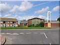
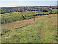
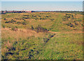
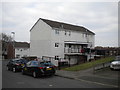
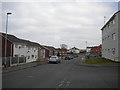
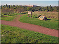
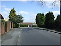
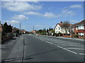
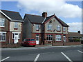
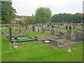
Photos of NG17 2FQ
Area Information
NG17 2FQ is a compact residential postcode in England, covering just 4.3 hectares and home to 1,335 people. Its high population density of 30,799 people per square kilometre suggests a tightly knit community, though the area’s small size means it is more of a cluster of homes than a sprawling suburb. Daily life here is shaped by proximity to essential services and transport links. The presence of multiple schools, including primary and nursery institutions, indicates a family-friendly character. While the area lacks large public spaces or commercial hubs, its proximity to rail networks and retail outlets within walking distance offers convenience. The postcode’s density and limited land area mean it is unlikely to expand significantly, making it a stable, if modest, residential choice. For buyers, NG17 2FQ offers a quiet, established environment with straightforward access to nearby towns and amenities, though its small footprint means it is best suited to those prioritising proximity over expansive living spaces.
- Area Type
- Postcode
- Area Size
- 4.3 hectares
- Population
- 1335
- Population Density
- 2293 people/km²
NG17 2FQ’s property market is characterised by a 39% home ownership rate, suggesting that most residents rent rather than own their homes. The accommodation type is predominantly houses, which may indicate a mix of older, established properties rather than newer developments. This owner-occupier percentage is lower than the national average, pointing to a rental market that could appeal to those seeking short-term or flexible housing. The small area size means the housing stock is limited, which may drive competition among buyers. For those considering purchase, the focus would likely be on existing homes rather than new builds. The presence of nearby rail stations and schools may enhance the area’s appeal, though the compact nature of NG17 2FQ means buyers should consider proximity to larger towns for more extensive property options.
House Prices in NG17 2FQ
Showing 33 properties
| Address | Type | Beds | Baths | Last Sale Price | Last Sale Date | |
|---|---|---|---|---|---|---|
| 24 The Oval, Sutton In Ashfield, NG17 2FQ | Semi-detached | 3 | 1 | £145,000 | Jan 2022 | |
| 28 The Oval, Sutton In Ashfield, NG17 2FQ | house | - | - | £150,000 | Sep 2021 | |
| 20 The Oval, Sutton In Ashfield, NG17 2FQ | house | - | - | £75,000 | Apr 2011 | |
| 18 The Oval, Sutton In Ashfield, NG17 2FQ | house | 3 | 1 | £88,000 | Oct 2006 | |
| 14 The Oval, Sutton In Ashfield, NG17 2FQ | Semi-detached | - | - | £47,000 | Jul 2001 | |
| 30 The Oval, Sutton In Ashfield, NG17 2FQ | house | - | - | £34,000 | Mar 2001 | |
| 34 The Oval, Sutton In Ashfield, NG17 2FQ | Detached | 3 | 1 | - | - | |
| 4 The Oval, Sutton In Ashfield, NG17 2FQ | Flat | - | - | - | - | |
| 12 The Oval, Sutton In Ashfield, NG17 2FQ | Flat | - | - | - | - | |
| 32 The Oval, Sutton In Ashfield, NG17 2FQ | house | - | - | - | - |
Energy Efficiency in NG17 2FQ
The lifestyle in NG17 2FQ is defined by its proximity to essential amenities. Retail options include local shops like Heron Stanton and Co-op outlets in Sutton in, providing access to daily necessities without the need for long trips. The rail network, with stations such as Sutton Parkway and Mansfield, connects residents to nearby towns, enhancing mobility for work or leisure. While the area lacks large parks or leisure facilities, its compact nature means residents can reach larger recreational spaces in adjacent areas. The presence of multiple schools and nurseries suggests a family-oriented environment, with community activities likely centred around local institutions. The combination of retail, transport, and education facilities makes daily life in NG17 2FQ practical, though it may appeal more to those who prioritise convenience over expansive leisure options.
Amenities
Schools
Residents of NG17 2FQ have access to several primary and nursery schools within practical reach. These include Sutton Nursery Centre, Carsic Infant School, Carsic Junior School, Carsic Primary School, and Brierley Forest Primary and Nursery School. The mix of nursery and primary schools suggests a strong focus on early education, which is beneficial for families with young children. The concentration of schools in the area may reduce the need for long commutes, though the absence of secondary schools means students would need to travel to nearby towns for higher education. The presence of multiple primary schools could also indicate a well-established local community, with schools serving as focal points for social interaction. For buyers prioritising schools, NG17 2FQ offers a range of options, though the lack of secondary education facilities is a consideration.
| Rank | School | Type | Entry gender | Ages |
|---|
Explore more schools in this area
Go to Schools tabDemographics
The population of NG17 2FQ has a median age of 47, with the majority of residents falling into the 30-64 age range. This suggests a community skewed towards middle-aged adults, likely with established careers and families. Home ownership stands at 39%, indicating that nearly two-thirds of households are renters, which may reflect the area’s smaller size and limited housing stock. The predominant accommodation type is houses, though the exact number of flats or other property types is not specified. Ethnically, the area is predominantly White, with no data provided on other groups. The high proportion of adults in the 30-64 bracket may influence local services and amenities, such as schools and healthcare. The relatively low home ownership rate could mean a transient population, though the area’s stability is reinforced by its proximity to transport links and schools.
Household Size
Accommodation Type
Tenure
Ethnic Group
Religion
Household Composition
Age
Household Deprivation
NS-SEC
Explore more demographic insights in this area
Go to Demographics tabPlanning
Planning Constraints
- Flood RiskPremium
- Ramsar Wetland SitesPremium
- Area of Outstanding Natural BeautyPremium
- Protected Nature ReservePremium
- Protected WoodlandPremium