Area Overview for NG17 2FJ
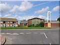
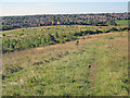
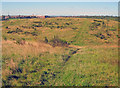
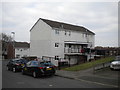
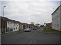
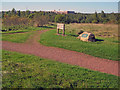
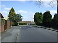
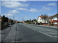
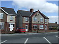
Photos of NG17 2FJ
Area Information
NG17 2FJ is a compact residential postcode area in England, covering 7,783 square metres and home to 1,335 residents. Its high population density of 171,534 people per square kilometre reflects a tightly knit community, where daily life is shaped by proximity to essential services and local amenities. The area’s small size means it is likely a cluster of homes within a single neighbourhood, with limited expansion potential. Residents here are predominantly adults aged 30–64, suggesting a mature, settled population. The presence of multiple primary schools and nearby rail stations indicates a focus on family-friendly infrastructure, though the area’s small footprint means it is not a sprawling suburb. Living in NG17 2FJ offers a mix of convenience and constraint: the compactness ensures easy access to local shops and transport, but the density may limit space for larger properties. It is a place where community ties are likely strong, with a balance of residential stability and practical connectivity.
- Area Type
- Postcode
- Area Size
- 7783 m²
- Population
- 1335
- Population Density
- 2293 people/km²
The property market in NG17 2FJ is characterised by a 39% home ownership rate, meaning that the majority of properties are likely rented. This suggests a rental-focused market, which may be influenced by the area’s small size and limited housing stock. The accommodation type is predominantly houses, indicating that the area does not include flats or apartments, which could appeal to buyers seeking traditional family homes. With only 7,783 square metres of space, the area is constrained, meaning property availability is limited. For buyers, this could mean higher competition for homes, though the presence of multiple schools and transport links may offset the compactness. The high population density also implies that properties are closely spaced, which could be a consideration for those seeking larger plots or open spaces. Overall, NG17 2FJ is a niche market, suitable for those prioritising proximity to amenities over expansive living areas.
House Prices in NG17 2FJ
Showing 22 properties
| Address | Type | Beds | Baths | Last Sale Price | Last Sale Date | |
|---|---|---|---|---|---|---|
| 43 Brierly Road, Sutton In Ashfield, NG17 2FJ | Semi-detached | 3 | - | £158,500 | Sep 2022 | |
| 7 Brierly Road, Sutton In Ashfield, NG17 2FJ | house | - | - | - | - | |
| 11 Brierly Road, Sutton In Ashfield, NG17 2FJ | house | - | - | - | - | |
| 37 Brierly Road, Sutton In Ashfield, NG17 2FJ | Flat | - | - | - | - | |
| 15 Brierly Road, Sutton In Ashfield, NG17 2FJ | house | - | - | - | - | |
| 33 Brierly Road, Sutton In Ashfield, NG17 2FJ | Flat | - | - | - | - | |
| 21 Brierly Road, Sutton In Ashfield, NG17 2FJ | house | - | - | - | - | |
| 1 Brierly Road, Sutton In Ashfield, NG17 2FJ | Semi-detached | - | - | - | - | |
| 13 Brierly Road, Sutton In Ashfield, NG17 2FJ | house | - | - | - | - | |
| 5 Brierly Road, Sutton In Ashfield, NG17 2FJ | house | - | - | - | - |
Energy Efficiency in NG17 2FJ
The lifestyle in NG17 2FJ is shaped by nearby amenities, including retail outlets such as Iceland Sutton, Asda Sutton, and Heron Carsic Estate. These shops provide access to groceries, household items, and other essentials, reducing the need for long trips to larger centres. The area’s rail stations, such as Sutton Parkway and Kirkby in Ashfield, enhance mobility, allowing residents to reach further destinations easily. While the data does not mention parks or leisure facilities, the presence of multiple schools and retail options suggests a focus on practicality over expansive recreational spaces. The compact nature of the area means that daily errands and travel are likely efficient, though the lack of detailed information on green spaces or cultural venues leaves some aspects of lifestyle unexplored. For those prioritising convenience and connectivity, NG17 2FJ offers a functional, if limited, array of amenities.
Amenities
Schools
NG17 2FJ is served by several primary schools, including Carsic Junior School, Carsic Infant School, Carsic Primary School, and Brierley Forest Primary and Nursery School, as well as Sutton Nursery Centre. These institutions provide a range of educational options for young children, with multiple primary schools likely offering choice and convenience for families. The presence of a nursery school suggests support for early years education, while the repetition of primary schools may indicate a focus on local schooling rather than secondary education. For families, this cluster of schools could reduce the need for long commutes, though no Ofsted ratings are provided to assess quality. The concentration of schools in the area may also contribute to a community feel, with parents and children frequently interacting in shared spaces. However, the absence of secondary schools means residents may need to travel further for older children’s education.
| Rank | School | Type | Entry gender | Ages |
|---|
Explore more schools in this area
Go to Schools tabDemographics
The population of NG17 2FJ is 1,335, with a median age of 47, indicating a predominantly middle-aged demographic. The most common age range is 30–64 years, suggesting a community of working-age adults and families with children. Home ownership rates stand at 39%, meaning that over two-thirds of households are likely renters, which may influence the local property market dynamics. The area is composed primarily of houses, reflecting a traditional residential layout rather than high-rise or apartment blocks. The predominant ethnic group is White, with no specific data on other demographics provided. The high population density of 171,534 people per square kilometre implies a tightly packed living environment, which may affect privacy and space per resident. This density, combined with the age profile, suggests a community that is stable but potentially less diverse in terms of generational or cultural makeup.
Household Size
Accommodation Type
Tenure
Ethnic Group
Religion
Household Composition
Age
Household Deprivation
NS-SEC
Explore more demographic insights in this area
Go to Demographics tabPlanning
Planning Constraints
- Flood RiskPremium
- Ramsar Wetland SitesPremium
- Area of Outstanding Natural BeautyPremium
- Protected Nature ReservePremium
- Protected WoodlandPremium