Area Overview for NG17 2EN
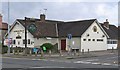
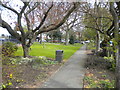
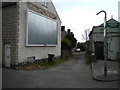
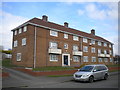
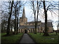
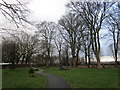
Photos of NG17 2EN


Area Information
NG17 2EN is a small, tightly packed residential area in England, covering just 7,356 square metres. With a population of 1,582 people, it is one of the most densely populated postcode areas in the country, at 215,055 people per square kilometre. This compact cluster of homes is ideal for those seeking a close-knit community with easy access to nearby services. Daily life here is defined by proximity to essential amenities, including shops, transport links, and schools. The area’s small size means residents are likely to know their neighbours, fostering a sense of familiarity. While the postcode is residential in focus, its limited size means it is best suited for those prioritising convenience over expansive living space. The area’s character is shaped by its modest scale, with no major landmarks or natural features, but its practicality and accessibility make it appealing to those who value efficiency in their surroundings.
- Area Type
- Postcode
- Area Size
- 7356 m²
- Population
- 1582
- Population Density
- 4315 people/km²
The property market in NG17 2EN is characterised by a high rate of home ownership (78%), which is significantly above the national average. This suggests that most properties are owner-occupied rather than rented out, indicating a stable and long-term resident base. The accommodation type is primarily houses, which is notable given the area’s small size. This mix of single-family homes may appeal to buyers seeking private, low-density living within a compact postcode. However, the limited area size means the housing stock is finite, and the immediate surroundings are likely to be similarly constrained. For buyers, this means competition for available properties and the need to consider proximity to the area’s amenities, such as schools and transport links, as key factors in their decision.
House Prices in NG17 2EN
Showing 17 properties
| Address | Type | Beds | Baths | Last Sale Price | Last Sale Date | |
|---|---|---|---|---|---|---|
| 104 Westbourne Road, Sutton In Ashfield, NG17 2EN | Detached | 3 | 2 | £225,000 | Dec 2024 | |
| 175 Westbourne Road, Sutton In Ashfield, NG17 2EN | Detached | 4 | 1 | £238,250 | Apr 2024 | |
| 106 Westbourne Road, Sutton In Ashfield, NG17 2EN | Retail | 3 | 1 | £225,000 | Jul 2022 | |
| 179 Westbourne Road, Sutton In Ashfield, NG17 2EN | Detached | 3 | 1 | £190,000 | Mar 2020 | |
| 159 Westbourne Road, Sutton In Ashfield, NG17 2EN | Detached | 3 | 1 | £150,000 | Jun 2017 | |
| 163 Westbourne Road, Sutton In Ashfield, NG17 2EN | Detached | 3 | 1 | £145,000 | Jun 2006 | |
| 177 Westbourne Road, Sutton In Ashfield, NG17 2EN | house | - | - | £59,950 | Jan 2001 | |
| 173 Westbourne Road, Sutton In Ashfield, NG17 2EN | Detached | - | - | £55,000 | Oct 1998 | |
| 167 Westbourne Road, Sutton In Ashfield, NG17 2EN | Detached | - | - | £59,300 | Jul 1998 | |
| 165 Westbourne Road, Sutton In Ashfield, NG17 2EN | Detached | 3 | 1 | - | - |
Energy Efficiency in NG17 2EN
The lifestyle in NG17 2EN is shaped by its proximity to essential amenities. Nearby retail options include Co-op Sutton in, Co-op Sutton, and Tesco Sutton, providing everyday shopping needs within easy reach. The area’s rail links to Sutton Parkway, Kirkby in Ashfield, and Mansfield enhance mobility, connecting residents to broader networks of services and employment opportunities. While the data does not specify parks or leisure facilities, the presence of multiple retail and transport hubs suggests a practical, convenience-focused lifestyle. The compact nature of the area means residents can access shops, transport, and schools without long commutes, fostering a self-contained community. This balance of accessibility and proximity to services supports a lifestyle that prioritises efficiency and ease of living.
Amenities
Schools
Residents of NG17 2EN have access to a range of educational institutions, including St Mary Magdalene CofE (VA) Primary School and Westbourne School. The former is a primary school with an Ofsted rating of ‘good’, offering a solid foundation for younger children. Westbourne School, a special school, also holds an Ofsted rating of ‘good’, catering to students with specific educational needs. The presence of both primary and special schools indicates a diverse educational landscape, supporting families with children of varying ages and requirements. While no secondary schools are listed, the proximity to nearby towns may provide additional options. The quality of these schools, combined with their ratings, suggests a reliable educational environment for families considering NG17 2EN.
| Rank | School | Type | Entry gender | Ages |
|---|
Explore more schools in this area
Go to Schools tabDemographics
The population of NG17 2EN is predominantly adults aged 30–64, with a median age of 47. This suggests a mature community, likely with established families or professionals settled in the area. Home ownership is high, at 78%, indicating a stable housing market where most residents live in their own homes rather than renting. The accommodation type is primarily houses, which is unusual for a densely populated area, suggesting a mix of single-family homes and possibly converted properties. The predominant ethnic group is White, though no specific diversity data is provided. The high home ownership rate and adult demographic imply a community with long-term residency and lower turnover. The population density, while extreme, does not necessarily correlate with deprivation, but it does mean shared resources and potential pressure on local services.
Household Size
Accommodation Type
Tenure
Ethnic Group
Religion
Household Composition
Age
Household Deprivation
NS-SEC
Explore more demographic insights in this area
Go to Demographics tabPlanning
Planning Constraints
- Flood RiskPremium
- Ramsar Wetland SitesPremium
- Area of Outstanding Natural BeautyPremium
- Protected Nature ReservePremium
- Protected WoodlandPremium