Area Overview for NG17 1NA
Photos of NG17 1NA

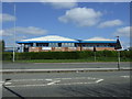
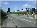

17 photos from this area
Area Information
Key information about the NG17 1NA including its size, population, and administrative classification.
- Area Type
- Postcode
- Area Size
- 1.9 hectares
- Population
- 2625
- Population Density
- 1992 people/km²
House Prices in NG17 1NA
42
Properties
£155,962
Average Sold Price
£99,000
Lowest Price
£270,000
Highest Price
Showing 42 properties
| Address | Type | Beds | Baths | Last Sale Price | Last Sale Date | |
|---|---|---|---|---|---|---|
| 5 Brandon Walk, Sutton In Ashfield, NG17 1NA | Detached | 3 | 2 | £270,000 | Jul 2025 | |
| 14 Brandon Walk, Sutton In Ashfield, NG17 1NA | Terraced | 2 | 1 | £162,000 | May 2025 | |
| 21 Brandon Walk, Sutton In Ashfield, NG17 1NA | Detached | 3 | 1 | £200,000 | Jan 2024 | |
| 27 Brandon Walk, Sutton In Ashfield, NG17 1NA | Semi-detached | 3 | 3 | £187,000 | Nov 2023 | |
| 1 Brandon Walk, Sutton In Ashfield, NG17 1NA | Detached | 3 | 1 | £178,000 | Feb 2021 | |
| 53 Brandon Walk, Sutton In Ashfield, NG17 1NA | Semi-detached | 3 | 2 | £175,000 | Dec 2020 | |
| 26 Brandon Walk, Sutton In Ashfield, NG17 1NA | Semi-detached | 3 | 2 | £145,000 | Dec 2020 | |
| 32 Brandon Walk, Sutton In Ashfield, NG17 1NA | Terraced | 2 | - | £132,000 | Oct 2020 | |
| 39 Brandon Walk, Sutton In Ashfield, NG17 1NA | house | - | - | £142,500 | Oct 2019 | |
| 35 Brandon Walk, Sutton In Ashfield, NG17 1NA | Bungalow | 2 | 1 | £140,000 | Jul 2019 |
Page 1 of 5
Energy Efficiency in NG17 1NA
Amenities
Schools
| Rank | School | Type | Entry gender | Ages |
|---|
Explore more schools in this area
Go to Schools tabDemographics
Household Size
Family (3-5 people)
most common
Accommodation Type
Houses
most common
Tenure
87
majority
Ethnic Group
White
most common
Religion
N/A
most common
Household Composition
N/A
most common
Age
47
median
Adults (30-64 years)
most common
Household Deprivation
N/A
with no deprivation
NS-SEC
39
in Lower managerial occupations
Explore more demographic insights in this area
Go to Demographics tabPlanning
Planning Constraints
- Flood RiskPremium
- Ramsar Wetland SitesPremium
- Area of Outstanding Natural BeautyPremium
- Protected Nature ReservePremium
- Protected WoodlandPremium