Area Overview for NG17 1GG
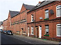
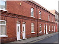
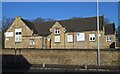
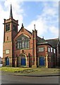
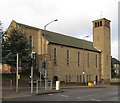
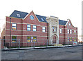
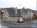
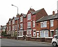
Photos of NG17 1GG


Area Information
Living in NG17 1GG means being part of a compact, densely populated residential cluster in England. The area covers 7,620 square metres and is home to 1,597 people, resulting in a population density of 209,571 people per square kilometre. This high density suggests a tight-knit community, though the small size means the area is likely to feel intimate rather than sprawling. The median age of 47 indicates a mature population, with the majority of residents aged between 30 and 64. This demographic suggests a mix of established families and long-term residents. The area’s proximity to rail networks and retail hubs adds practicality to daily life, while the absence of environmental constraints like protected woodlands or wetlands means development and living are not hindered by natural restrictions. For buyers, NG17 1GG offers a blend of accessibility and local amenities, though its small footprint means the character of the neighbourhood is defined by its immediate surroundings.
- Area Type
- Postcode
- Area Size
- 7620 m²
- Population
- 1597
- Population Density
- 4854 people/km²
The property market in NG17 1GG is characterised by a high rate of home ownership, with 65% of residents owning their homes. This suggests a market dominated by owner-occupied properties rather than rental units, which may indicate a stable, long-term population. The accommodation type is primarily houses, meaning the area lacks flats or apartments, which could appeal to buyers seeking family homes or those prioritising private space. Given the small size of the area, the housing stock is likely limited, making properties in NG17 1GG potentially competitive. Buyers should consider the proximity to rail links and retail amenities as key selling points, though the compact nature of the area means the immediate surroundings are crucial for assessing property value. The lack of environmental constraints, such as protected sites, may also make the area more attractive for development or investment.
House Prices in NG17 1GG
Showing 34 properties
| Address | Type | Beds | Baths | Last Sale Price | Last Sale Date | |
|---|---|---|---|---|---|---|
| 63 Kirkby Road, Sutton In Ashfield, NG17 1GG | Terraced | 2 | - | £74,000 | Oct 2023 | |
| Sutton House, 57 Kirkby Road, Sutton In Ashfield, NG17 1GG | hospital_care_home | - | - | £2,870,000 | Nov 2021 | |
| 81 Kirkby Road, Sutton In Ashfield, NG17 1GG | house | - | - | £200,000 | Sep 2021 | |
| 85 Kirkby Road, Sutton In Ashfield, NG17 1GG | Terraced | 4 | 2 | £226,000 | Dec 2020 | |
| 77 Kirkby Road, Sutton In Ashfield, NG17 1GG | Flat | - | - | £82,000 | Oct 2020 | |
| 67 Kirkby Road, Sutton In Ashfield, NG17 1GG | Terraced | 2 | 1 | £90,000 | Nov 2019 | |
| 61 Kirkby Road, Sutton In Ashfield, NG17 1GG | Retail | - | - | £53,000 | Jul 2018 | |
| 73 Kirkby Road, Sutton In Ashfield, NG17 1GG | Terraced | 3 | 1 | £65,000 | Feb 2018 | |
| 75 Kirkby Road, Sutton In Ashfield, NG17 1GG | Terraced | 2 | 1 | £70,000 | Mar 2016 | |
| 83 Kirkby Road, Sutton In Ashfield, NG17 1GG | house | 4 | - | £175,000 | Mar 2012 |
Energy Efficiency in NG17 1GG
Residents of NG17 1GG have access to a range of nearby amenities within practical reach. Retail options include Co-op Sutton in, Heron Carsic Estate Sutton in, and Iceland Sutton, providing essential shopping and services. The area’s rail network is particularly well-connected, with stations like Sutton Parkway, Kirkby in Ashfield, and Mansfield offering links to surrounding towns and cities. While the data does not specify parks or leisure facilities, the absence of protected natural areas suggests that local amenities may be focused on practical needs rather than expansive green spaces. The compact nature of the area means that daily life is centred around these nearby hubs, with convenience and accessibility shaping the local lifestyle. The combination of retail and transport options makes NG17 1GG suitable for those prioritising ease of access over large-scale recreational facilities.
Amenities
Schools
| Rank | School | Type | Entry gender | Ages |
|---|
Explore more schools in this area
Go to Schools tabDemographics
The community in NG17 1GG is predominantly composed of adults aged 30 to 64, with a median age of 47. This suggests a population that is largely settled, with fewer young families or elderly residents compared to other areas. Home ownership is strong, with 65% of households owning their properties. The accommodation type is primarily houses, indicating a preference for standalone homes over flats or apartments. The predominant ethnic group is White, though no specific data on diversity or deprivation is provided. The high proportion of owner-occupied houses suggests a stable, long-term resident base. The age profile and ownership rates imply a community focused on stability, with fewer transient residents. This demographic structure may influence local services and amenities, tailored to the needs of middle-aged adults and families.
Household Size
Accommodation Type
Tenure
Ethnic Group
Religion
Household Composition
Age
Household Deprivation
NS-SEC
Explore more demographic insights in this area
Go to Demographics tabPlanning
Planning Constraints
- Flood RiskPremium
- Ramsar Wetland SitesPremium
- Area of Outstanding Natural BeautyPremium
- Protected Nature ReservePremium
- Protected WoodlandPremium