Area Overview for NG17 1ET
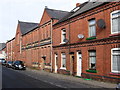
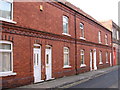
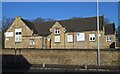
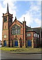
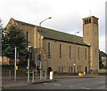
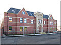
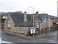
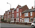
Photos of NG17 1ET


Area Information
Living in NG17 1ET means being part of a small, tightly packed residential cluster in England. With a population of 1,597 spread across just 1.3 hectares, this area is characterised by high density and a focus on compact living. The community is predominantly composed of adults aged 30–64, reflecting a mature demographic with a median age of 47. This suggests a stable, established population, likely with long-term ties to the area. Daily life here is shaped by proximity to essential services and transport links, with residents enjoying access to multiple retail outlets and rail stations within practical reach. The area’s small size means a strong sense of local identity, though its limited space may constrain expansion. For those seeking a quiet, close-knit environment with a balance of convenience and privacy, NG17 1ET offers a distinct alternative to larger urban centres. Its compact nature also means that amenities and services are closely clustered, reducing the need for long commutes. However, the high population density may influence the pace of life, with a focus on efficiency and community interaction.
- Area Type
- Postcode
- Area Size
- 1.3 hectares
- Population
- 1597
- Population Density
- 4854 people/km²
The property market in NG17 1ET is dominated by owner-occupied homes, with 65% of residents living in properties they own. The accommodation type is primarily houses, suggesting a mix of family homes and semi-detached properties. Given the area’s small size of 1.3 hectares and high population density, the housing stock is limited, with little scope for new developments. This makes the area attractive to buyers seeking established properties but may require those looking for more space to consider nearby areas. The high home ownership rate indicates a stable market with long-term residents, reducing the likelihood of rental properties dominating the scene. For buyers, this means a focus on existing homes rather than new builds, though the limited size of NG17 1ET may mean competition for available properties. The area’s proximity to rail stations also enhances its appeal for commuters, though the compact nature of the postcode may limit options for larger homes.
House Prices in NG17 1ET
Showing 8 properties
| Address | Type | Beds | Baths | Last Sale Price | Last Sale Date | |
|---|---|---|---|---|---|---|
| Orchard Lodge, Off The Avenue, Sutton In Ashfield, NG17 1ET | Bungalow | 4 | 1 | £196,000 | Jul 2018 | |
| Brooklands, Off The Avenue, Sutton In Ashfield, NG17 1ET | Detached | 4 | 1 | £230,000 | May 2018 | |
| April Cottage, Off The Avenue, Sutton In Ashfield, NG17 1ET | house | - | - | £149,995 | Oct 2007 | |
| Redgate, Off The Avenue, Sutton In Ashfield, NG17 1ET | Bungalow | 4 | 2 | - | - | |
| 2 Off The Avenue, Sutton In Ashfield, NG17 1ET | Detached | 4 | - | - | - | |
| Grey Gables, Off The Avenue, Sutton In Ashfield, NG17 1ET | Land | - | - | - | - | |
| Twin Oaks, Off The Avenue, Sutton In Ashfield, NG17 1ET | Land | - | - | - | - | |
| Private Road Off The Avenue, The Avenue, Sutton In Ashfield, NG17 1ET | undefined | - | - | - | - |
Energy Efficiency in NG17 1ET
Residents of NG17 1ET have access to a range of nearby amenities, including five retail outlets such as Co-op Sutton in, Tesco Sutton, and Co-op Sutton. These shops provide essential services for daily living, from groceries to household supplies. The area’s rail network is particularly well-connected, with five stations offering links to Sutton Parkway, Kirkby in Ashfield, and Mansfield. These stations facilitate easy travel to larger towns and cities, expanding the lifestyle options available to residents. While the area itself is small, the proximity to multiple retail and transport hubs ensures convenience without the need for long commutes. The compact nature of NG17 1ET means that amenities are closely clustered, fostering a sense of community and reducing the time required for errands. For those who prefer a slower pace, the limited size of the area may encourage a focus on local interactions and nearby services rather than sprawling urban environments.
Amenities
Schools
| Rank | School | Type | Entry gender | Ages |
|---|
Explore more schools in this area
Go to Schools tabDemographics
The community in NG17 1ET is predominantly composed of adults aged 30–64, making up the most common age range. With a median age of 47, the area reflects a mature population, likely with established careers and family ties. Home ownership is high at 65%, indicating a strong presence of long-term residents who have invested in property. The accommodation type is primarily houses, suggesting a mix of family homes and semi-detached properties. The predominant ethnic group is White, though the data does not specify further diversity metrics. The population density of 125,351 people per square kilometre is exceptionally high, which may influence the character of daily life, with limited open space and a focus on shared infrastructure. This density, combined with the high home ownership rate, points to a stable, settled community. However, the lack of specific data on deprivation or income levels means that the area’s socioeconomic challenges remain unquantified.
Household Size
Accommodation Type
Tenure
Ethnic Group
Religion
Household Composition
Age
Household Deprivation
NS-SEC
Explore more demographic insights in this area
Go to Demographics tabPlanning
Planning Constraints
- Flood RiskPremium
- Ramsar Wetland SitesPremium
- Area of Outstanding Natural BeautyPremium
- Protected Nature ReservePremium
- Protected WoodlandPremium