Area Overview for NG17 1BS
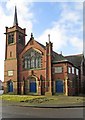
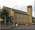
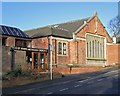
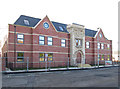
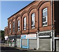
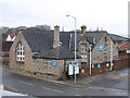
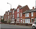
Photos of NG17 1BS

Area Information
NG17 1BS is a compact residential postcode area in England, covering 4,021 square metres and home to 2,013 residents. Its population density of 500,619 people per square kilometre reflects a tightly knit community, where proximity to amenities and transport links shapes daily life. This area is characterised by its small-scale residential cluster, offering a mix of convenience and quiet living. Residents benefit from being near key services, including retail hubs and rail stations, while the surrounding environment remains relatively unspoiled by large-scale development. The area’s appeal lies in its balance of accessibility and seclusion, making it suitable for those seeking a connected yet low-maintenance lifestyle. With a median age of 47 and a population skewed toward adults aged 30–64, the community is mature and stable, with a focus on established households. Living here means navigating a high-density environment, but the presence of essential services within walking or short driving distance ensures practicality for everyday needs.
- Area Type
- Postcode
- Area Size
- 4021 m²
- Population
- 2013
- Population Density
- 4441 people/km²
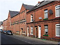
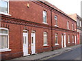
The property market in NG17 1BS is defined by a 43% home ownership rate, indicating that less than half of properties are owner-occupied. The remaining properties are likely rented, though specific rental data is not provided. The area’s accommodation type is predominantly houses, which contrasts with regions where flats or apartments dominate. This suggests a housing stock suited to families or individuals preferring standalone homes. Given the small area size and high population density, the available housing is likely limited, potentially making the market competitive for buyers. The focus on houses may appeal to those seeking space, though the compact nature of the postcode means proximity to amenities and transport is a key selling point. For buyers, the challenge lies in navigating a small, saturated market where properties are scarce but essential services are within reach.
House Prices in NG17 1BS
Showing 7 properties
| Address | Type | Beds | Baths | Last Sale Price | Last Sale Date | |
|---|---|---|---|---|---|---|
| Spring Bungalow, High Pavement, Sutton In Ashfield, NG17 1BS | Bungalow | 2 | 1 | £182,000 | Jul 2023 | |
| Windrush, High Pavement, Sutton In Ashfield, NG17 1BS | Bungalow | - | - | £255,000 | Sep 2021 | |
| Whyburn, High Pavement, Sutton In Ashfield, NG17 1BS | house | - | - | £220,000 | Mar 2018 | |
| Bank House, High Pavement, Sutton In Ashfield, NG17 1BS | Semi-detached | 4 | 2 | £210,000 | Aug 2016 | |
| Orchard Cottage, 99 High Pavement, Sutton In Ashfield, NG17 1BS | Bungalow | 2 | 2 | £170,000 | Jul 2016 | |
| Bank Stile, High Pavement, Sutton In Ashfield, NG17 1BS | Semi-detached | - | - | £62,500 | Feb 2002 | |
| Amberyl, High Pavement, Sutton In Ashfield, NG17 1BS | house | - | - | - | - |
Energy Efficiency in NG17 1BS
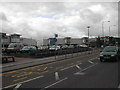
Residents of NG17 1BS have access to a range of retail and transport amenities within practical reach. The area includes five retail outlets, such as Heron Carsic Estate, Iceland, and Co-op Sutton in, offering everyday shopping needs. Nearby rail stations, including Sutton Parkway and Mansfield, provide connections to surrounding areas, facilitating travel for work, leisure, or socialising. While the data does not mention parks or leisure facilities, the proximity to rail and retail suggests a lifestyle focused on convenience and connectivity. The compact nature of the postcode means amenities are clustered, reducing travel time for essentials. However, the absence of specific details on green spaces or recreational areas leaves room for further investigation into the area’s leisure options. Overall, the lifestyle here balances practicality with accessibility, though buyers may wish to explore local parks or community hubs for a fuller picture of daily life.
Amenities
Schools
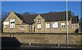
Residents of NG17 1BS have access to two notable schools. Sutton Centre Community College is a primary school, providing early education for younger children. Nearby, Sutton Community Academy is an academy with a ‘good’ Ofsted rating, offering secondary education. The combination of a primary school and an academy suggests a range of educational options for families, from early years through to secondary schooling. The presence of a rated academy may be a significant draw for parents prioritising quality education. While no other schools are listed, the availability of both primary and secondary institutions within the area reduces the need for long commutes. This makes NG17 1BS appealing for families seeking a self-contained educational environment, though the exact catchment areas and student numbers are not specified.
| Rank | School | Type | Entry gender | Ages |
|---|
Explore more schools in this area
Go to Schools tabDemographics
The population of NG17 1BS is predominantly composed of adults aged 30–64, reflecting a mature demographic with a median age of 47. Home ownership accounts for 43% of properties, suggesting a mix of owner-occupied and rental homes. The area’s accommodation type is largely houses, indicating a preference for standalone properties over flats or apartments. The predominant ethnic group is White, with no data provided on other ethnicities. The high population density of 500,619 people per square kilometre implies a tightly packed residential layout, which may influence the character of local interactions and community dynamics. While the data does not specify deprivation levels, the concentration of older adults and the prevalence of family homes suggest a stable, long-term resident base. This profile positions NG17 1BS as a place where established communities coexist with practical housing options, though the density may impact personal space and privacy.
Household Size
Accommodation Type
Tenure
Ethnic Group
Religion
Household Composition
Age
Household Deprivation
NS-SEC
Explore more demographic insights in this area
Go to Demographics tabPlanning
Planning Constraints
- Flood RiskPremium
- Ramsar Wetland SitesPremium
- Area of Outstanding Natural BeautyPremium
- Protected Nature ReservePremium
- Protected WoodlandPremium