Area Overview for NG17 1BL
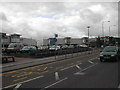
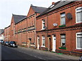
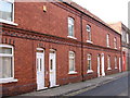
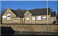
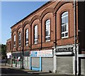
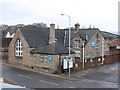
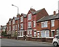
Photos of NG17 1BL

Area Information
NG17 1BL is a compact residential postcode in England, covering just 3180 square metres and home to 1497 people. Despite its small size, the area has a high population density of 470,713 people per square kilometre, reflecting a tightly knit community. This postcode is characterised by a focus on housing, with most properties being houses rather than flats. The median age of residents is 47, with the majority falling in the 30-64 age range, suggesting a stable, adult-oriented demographic. Living here means proximity to essential amenities, including five retail outlets such as Asda Sutton and Iceland, as well as rail connections like Sutton Parkway and Mansfield stations. While the area lacks natural beauty designations or protected sites, it offers practical connectivity and a mix of independent and public services. For buyers, NG17 1BL represents a small but functional living space with direct access to local infrastructure, though its limited size may mean competition for available properties.
- Area Type
- Postcode
- Area Size
- 3180 m²
- Population
- 1497
- Population Density
- 4642 people/km²
The property market in NG17 1BL is defined by a 40% home ownership rate, with the remaining 60% of residents likely renting. This indicates a balance between owner-occupied and rental properties, though the small area size means the housing stock is limited. The accommodation type is predominantly houses, which may appeal to families or those seeking more space. Given the high population density, properties are likely to be closely spaced, which could influence both property values and the availability of larger homes. For buyers, the area’s compact nature means competition for available properties, particularly as the market is focused on single-family dwellings. Those seeking a rental property may find a range of options, but the overall supply is constrained by the postcode’s small size. The lack of flats or apartments suggests that the area is not ideal for those prioritising high-density living.
House Prices in NG17 1BL
Showing 2 properties
| Address | Type | Beds | Baths | Last Sale Price | Last Sale Date | |
|---|---|---|---|---|---|---|
| 18A The Idlewells, Sutton In Ashfield, NG17 1BL | undefined | - | - | - | - | |
| 18A The Idlewells, Sutton In Ashfield, NG17 1BL | shop | - | - | - | - |
Energy Efficiency in NG17 1BL
Daily life in NG17 1BL is shaped by its proximity to essential amenities. The area includes five retail outlets, such as Asda Sutton and Iceland, offering convenience for shopping and daily necessities. Rail stations like Sutton Parkway and Mansfield provide direct links to broader transport networks, enhancing mobility. While the data does not mention parks or leisure facilities, the presence of retail and rail options suggests a focus on practicality over recreation. The compact nature of the postcode means amenities are closely clustered, reducing travel times for errands or commuting. However, the absence of specific details on green spaces or cultural venues means residents may need to look beyond the immediate area for leisure activities. Overall, the lifestyle in NG17 1BL is defined by accessibility and efficiency, though it lacks the diversity of amenities found in larger towns.
Amenities
Schools
The nearest school to NG17 1BL is Lammas School, an independent institution. While no Ofsted rating is provided, the presence of an independent school suggests a focus on private education for families in the area. The absence of state schools in the data means the educational options are limited to this single institution. For families prioritising independent schooling, Lammas offers a dedicated option, though it may not cater to all needs. The lack of additional schools nearby implies that parents must consider commuting or alternative educational provisions. Given the area’s small size, the school’s proximity to NG17 1BL is a key factor for families seeking a local education. However, without further details on the school’s curriculum or facilities, prospective residents must rely on external reviews or direct inquiries to assess its suitability.
| Rank | School | Type | Entry gender | Ages |
|---|
Explore more schools in this area
Go to Schools tabDemographics
The community in NG17 1BL is predominantly composed of adults aged 30-64, with a median age of 47. This suggests a mature population, likely with established careers and family structures. Home ownership stands at 40%, indicating a significant proportion of residents rent their homes. The area’s accommodation is primarily houses, reflecting a preference for single-family dwellings over flats or apartments. The predominant ethnic group is White, though no specific data on diversity or deprivation is provided. The high population density of 470,713 people per square kilometre implies a closely packed residential environment, which may influence the character of daily life. With no mention of social deprivation metrics, it is unclear how this density affects access to services or quality of life. However, the presence of nearby retail and rail links suggests that the area is designed to meet the needs of its residents, even within its constrained footprint.
Household Size
Accommodation Type
Tenure
Ethnic Group
Religion
Household Composition
Age
Household Deprivation
NS-SEC
Explore more demographic insights in this area
Go to Demographics tabPlanning
Planning Constraints
- Flood RiskPremium
- Ramsar Wetland SitesPremium
- Area of Outstanding Natural BeautyPremium
- Protected Nature ReservePremium
- Protected WoodlandPremium