Area Overview for NG17 1AH
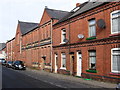
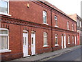
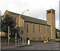
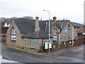
Photos of NG17 1AH


Area Information
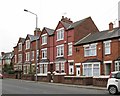
Living in NG17 1AH means being part of a small, tightly knit residential cluster in England. With a population of just 1,195, the area feels intimate, offering a quiet alternative to larger towns. The community is predominantly composed of adults aged 30–64, suggesting a mature demographic with established routines. Daily life here is shaped by proximity to key amenities, including five retail outlets such as Iceland and Asda, and five railway stations like Sutton Parkway and Mansfield, which provide easy access to nearby towns. The area’s low flood risk and absence of environmental constraints make it a practical choice for those prioritising safety and planning certainty. While the population is small, the presence of multiple transport links and shops ensures convenience without the bustle of a larger urban centre. For buyers seeking a peaceful, manageable community with straightforward infrastructure, NG17 1AH offers a straightforward proposition. Its compact size means residents are likely to know their neighbours, and the area’s character is defined by its blend of residential simplicity and accessible connectivity.
- Area Type
- Postcode
- Area Size
- Not available
- Population
- 1195
- Population Density
- 3304 people/km²
The property market in NG17 1AH is characterised by a low home ownership rate of 38%, with houses making up the majority of accommodation. This suggests a market where rental properties dominate, though the small population size means the housing stock is limited. The prevalence of houses rather than flats or apartments indicates a more traditional, possibly older built environment, which may appeal to buyers seeking family homes or those prioritising space. However, the small area’s size means the immediate housing options are constrained, and buyers may need to look beyond NG17 1AH for more choices. The low home ownership rate also implies that the area is not a strong candidate for property investment, as demand for rental properties may be limited by the small local population. For those considering a move, the market’s compact nature means proximity to nearby towns could be a key consideration.
House Prices in NG17 1AH
Showing 1 properties
| Address | Type | Beds | Baths | Last Sale Price | Last Sale Date | |
|---|---|---|---|---|---|---|
| Ground Floor And First Floor, Opas House, 5-25 Market Street, Sutton In Ashfield, NG17 1AH | Office | - | - | - | - |
Energy Efficiency in NG17 1AH
Residents of NG17 1AH have access to a range of nearby amenities, including five retail outlets such as Iceland, Asda, and Heron Carsic Estate in Sutton, which provide everyday shopping convenience. The area’s railway stations—Sutton Parkway, Kirkby in Ashfield, and Mansfield—offer easy travel to larger towns and cities, expanding access to cultural, professional, and recreational opportunities. While the area itself is small, the proximity to these amenities ensures residents can meet daily needs without long commutes. The retail options suggest a focus on practicality, with supermarkets and local stores catering to household requirements. For those who prefer to stay local, the area’s compact size means amenities are within walking or short driving distance. The combination of retail, rail, and nearby towns creates a lifestyle that balances self-sufficiency with regional connectivity.
Amenities
Schools
| Rank | School | Type | Entry gender | Ages |
|---|
Explore more schools in this area
Go to Schools tabDemographics
The community in NG17 1AH is predominantly composed of adults aged 30–64, with a median age of 47. This suggests a population of middle-aged individuals, many of whom may be in their peak working years or nearing retirement. Home ownership here is relatively low at 38%, indicating a significant proportion of residents rent their homes. The area’s accommodation is primarily houses, which is unusual in many modern housing markets, suggesting a more traditional, possibly older housing stock. The predominant ethnic group is White, with no data provided on other groups. This demographic profile implies a stable, long-established community with limited recent migration. The low home ownership rate may reflect economic factors or a preference for rental living, but it also means the area is not a hotspot for investment property. For buyers, this suggests a market where owner-occupation is less common, and rental availability could be a factor to consider.
Household Size
Accommodation Type
Tenure
Ethnic Group
Religion
Household Composition
Age
Household Deprivation
NS-SEC
Explore more demographic insights in this area
Go to Demographics tabPlanning
Planning Constraints
- Flood RiskPremium
- Ramsar Wetland SitesPremium
- Area of Outstanding Natural BeautyPremium
- Protected Nature ReservePremium
- Protected WoodlandPremium