Area Overview for NG17 0DX
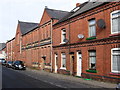
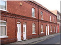
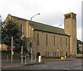
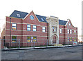
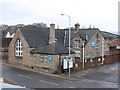
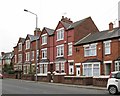
Photos of NG17 0DX


Area Information
Living in NG17 0DX means being part of a small, tightly knit residential cluster in England. With a population of 2013, this area is compact but functional, offering a balance between suburban convenience and proximity to essential services. The community is predominantly composed of adults aged 30–64, reflecting a mature demographic with established roots. Daily life here is shaped by nearby amenities, including retail outlets and rail connections, which make commuting and shopping straightforward. The area’s small size means it is likely surrounded by similar clusters, creating a network of interconnected neighbourhoods. While there is no indication of historical or cultural landmarks, the practical layout ensures residents have access to necessary infrastructure. For those seeking a quiet, stable environment with accessible services, NG17 0DX provides a foundation for everyday living, though its character is defined more by functionality than distinctiveness.
- Area Type
- Postcode
- Area Size
- Not available
- Population
- 2013
- Population Density
- 4441 people/km²
The property market in NG17 0DX is characterised by a 43% home ownership rate, indicating that nearly half of residents own their homes. The predominant accommodation type is houses, which suggests a focus on family-friendly or semi-detached housing stock. This contrasts with areas where flats or apartments dominate, and may appeal to buyers seeking more space or traditional housing. However, the relatively low home ownership rate implies that a significant portion of the housing stock is rented, potentially offering opportunities for investors or tenants. As a small area, the market may be limited in scale, with properties likely concentrated in nearby clusters. Buyers should consider the area’s proximity to rail links and retail amenities, which could enhance its appeal. The lack of specific data on property prices or trends means the market’s dynamics remain opaque, but the existing data points to a mix of owner-occupied and rental properties.
House Prices in NG17 0DX
No properties found in this postcode.
Energy Efficiency in NG17 0DX
The lifestyle in NG17 0DX is shaped by its proximity to essential amenities. Retail options include five venues such as Asda, Iceland, and Heron Carsic Estate, offering a range of shopping experiences from supermarkets to specialty stores. These shops cater to daily needs, reducing the necessity for long trips to larger centres. The area’s rail network, with stations like Sutton Parkway and Mansfield, provides access to broader regional connectivity, enabling residents to travel easily for work, leisure, or socialising. While there is no mention of parks or leisure facilities in the data, the presence of retail and transport links suggests a focus on practicality over recreation. The character of the area is defined by convenience, with amenities clustered to serve the local population efficiently. For those prioritising accessibility over expansive green spaces, NG17 0DX offers a straightforward, service-oriented lifestyle.
Amenities
Schools
Residents of NG17 0DX have access to two nearby schools. Sutton Centre Community College is a primary school, providing education for younger children, while Sutton Community Academy is an academy with a good Ofsted rating. The combination of a primary school and an academy offers families a range of educational options, from early years to secondary education. The good Ofsted rating for the academy suggests a reliable standard of teaching and facilities, which is a key consideration for parents. However, the data does not mention other schools in the area, so families may need to look beyond NG17 0DX for additional options. The presence of both a primary and secondary-level institution within practical reach makes the area suitable for families prioritising convenience in education.
| Rank | School | Type | Entry gender | Ages |
|---|
Explore more schools in this area
Go to Schools tabDemographics
The population of NG17 0DX is 2013, with a median age of 47, indicating a community skewed towards middle-aged adults. The most common age range is 30–64, suggesting a mix of working professionals and families. Home ownership stands at 43%, meaning nearly half of residents live in properties they own, while the rest may be renting. The predominant accommodation type is houses, which aligns with the area’s residential focus. The dominant ethnic group is White, though no data is provided on other demographics. The age profile implies a stable, long-term resident base, with fewer young families or retirees compared to other areas. This demographic structure may influence local services and amenities, as demand for schools and healthcare is likely moderate. The lack of detailed diversity data means the community’s full composition remains unclear, but the figures suggest a homogeneous, established population.
Household Size
Accommodation Type
Tenure
Ethnic Group
Religion
Household Composition
Age
Household Deprivation
NS-SEC
Explore more demographic insights in this area
Go to Demographics tabPlanning
Planning Constraints
- Flood RiskPremium
- Ramsar Wetland SitesPremium
- Area of Outstanding Natural BeautyPremium
- Protected Nature ReservePremium
- Protected WoodlandPremium