Area Overview for NG16 6RT
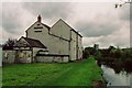
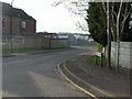
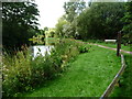
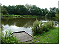
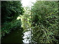
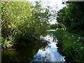
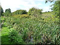
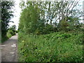
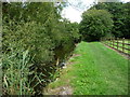
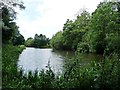
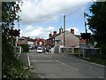
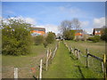
Photos of NG16 6RT
Area Information
NG16 6RT is a small, tightly packed residential postcode in England, home to 1,333 people spread across a compact area with a density of 760 people per square kilometre. This is a community of adults, with the majority aged between 30 and 64, reflecting a mature, settled population. The area’s small size means it is likely to feel close-knit, with residents accustomed to a slower pace of life. Proximity to retail hubs like Co-op Pinxton and rail stations such as Alfreton and Kirkby in Ashfield suggests easy access to daily essentials and regional connectivity. While the area lacks large-scale amenities, its compact nature ensures that services are within practical reach. The presence of two schools, including an outstanding-rated academy, adds to its appeal for families. For those seeking a quiet, manageable postcode with a balance of local convenience and regional access, NG16 6RT offers a straightforward, no-frills lifestyle.
- Area Type
- Postcode
- Area Size
- Not available
- Population
- 1333
- Population Density
- 760 people/km²
NG16 6RT is a predominantly owner-occupied area, with 65% of homes owned by residents rather than rented. The accommodation type is exclusively houses, indicating a lack of flats or apartments. This suggests a housing stock tailored to families or individuals seeking private, standalone properties. Given the small size of the postcode, the property market is likely limited to a handful of homes, with limited scope for new developments. Buyers should expect a low turnover of properties, with prices influenced by the area’s compact nature and proximity to nearby towns. The absence of rental properties implies that the market caters more to long-term residents than to short-term lets or investors.
House Prices in NG16 6RT
No properties found in this postcode.
Energy Efficiency in NG16 6RT
Residents of NG16 6RT have access to nearby retail options such as Co-op Pinxton, Morrisons Daily, and M&S Mansfield, ensuring daily shopping needs are met without long journeys. The area’s rail stations connect to broader networks, offering access to larger towns and cities. While there is no mention of parks or leisure facilities in the data, the proximity to rail and retail suggests a lifestyle focused on practicality and regional access. The compact nature of the postcode means amenities are within walking or short driving distance, supporting a low-maintenance, convenience-driven routine.
Amenities
Schools
Residents of NG16 6RT have access to two primary schools within practical reach. Longwood Community Infant School serves as a traditional primary institution, while Longwood Infant Academy is an academy with an outstanding Ofsted rating. The presence of both a standard primary school and a high-performing academy provides families with choice and flexibility. The outstanding rating at Longwood Infant Academy suggests strong academic performance and resources, which could be a key draw for families prioritising education. However, the absence of secondary schools in the immediate area means students may need to travel to nearby towns for further education.
| Rank | School | Type | Entry gender | Ages |
|---|
Explore more schools in this area
Go to Schools tabDemographics
The population of NG16 6RT is predominantly adults, with a median age of 47 and 65% of residents owning their homes. The accommodation type is primarily houses, reflecting a demographic that values private, family-oriented living. The majority of the population identifies as White, with no specific data on other ethnic groups provided. The age range of 30–64 years indicates a community of established professionals and families, rather than a student or younger population. With no data on deprivation levels, it is unclear how this affects access to services, but the high home ownership rate suggests a stable, long-term resident base. The absence of significant demographic diversity means the area is likely to have a uniform cultural and social profile.
Household Size
Accommodation Type
Tenure
Ethnic Group
Religion
Household Composition
Age
Household Deprivation
NS-SEC
Explore more demographic insights in this area
Go to Demographics tabPlanning
Planning Constraints
- Flood RiskPremium
- Ramsar Wetland SitesPremium
- Area of Outstanding Natural BeautyPremium
- Protected Nature ReservePremium
- Protected WoodlandPremium