Area Overview for NG16 6RS
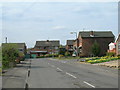
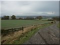
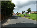
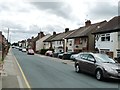
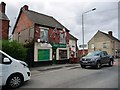
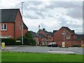
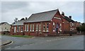
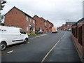
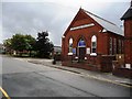
Photos of NG16 6RS

Area Information
NG16 6RS is a small residential postcode cluster in England, covering just 6,901 square metres and home to 1,502 people. This compact area has a high population density of 217,637 people per square kilometre, reflecting its tightly knit community. The area is characterised by a predominance of owner-occupied homes, with 84% of properties owned by residents. Most residents are adults aged between 30 and 64, creating a stable, mature demographic. Daily life here is shaped by proximity to essential services, with five retail outlets including Co-op stores in nearby Selston, Skegby, and Pinxton. The area’s small size means residents are likely to know their neighbours, fostering a sense of community. While the postcode itself is limited in physical space, its connectivity to rail and tram networks ensures access to broader regional amenities. The area’s low crime risk and absence of environmental constraints make it appealing for those seeking a safe, focused living environment without the pressures of larger urban centres.
- Area Type
- Postcode
- Area Size
- 6901 m²
- Population
- 1502
- Population Density
- 2220 people/km²
The property market in NG16 6RS is dominated by owner-occupied homes, with 84% of properties owned by residents. This high rate of home ownership suggests a stable, long-term market with limited rental activity. The accommodation type is predominantly houses, which is unusual for a small postcode area but may indicate a mix of older, larger properties or a focus on family homes. Given the area’s compact size, the housing stock is likely limited, with few new developments. Buyers considering this area should expect a niche market where properties are likely to be in established condition, with little turnover. The proximity to rail and tram networks may make it attractive for commuters, though the small size means competition for available homes could be intense. For those seeking a quiet, owner-occupied environment with minimal rental pressure, NG16 6RS offers a distinct proposition.
House Prices in NG16 6RS
Showing 16 properties
| Address | Type | Beds | Baths | Last Sale Price | Last Sale Date | |
|---|---|---|---|---|---|---|
| 3 Middleton Close, Selston, NG16 6RS | Detached | 3 | 2 | £262,000 | Jan 2025 | |
| 7 Middleton Close, Selston, NG16 6RS | Detached | 3 | 2 | £248,000 | Jan 2025 | |
| 19 Middleton Close, Selston, NG16 6RS | Semi-detached | 2 | 1 | £140,000 | Feb 2024 | |
| 1 Middleton Close, Selston, NG16 6RS | Detached | 3 | 2 | £234,000 | Jun 2022 | |
| 12 Middleton Close, Selston, NG16 6RS | house | - | - | £190,000 | Sep 2021 | |
| 5 Middleton Close, Selston, NG16 6RS | Detached | 3 | - | £165,000 | Feb 2020 | |
| 17 Middleton Close, Selston, NG16 6RS | house | - | - | £102,000 | Sep 2018 | |
| 10 Middleton Close, Selston, NG16 6RS | house | - | - | £132,000 | Jun 2018 | |
| 6 Middleton Close, Selston, NG16 6RS | Semi-detached | 3 | - | £137,500 | Nov 2017 | |
| 21 Middleton Close, Selston, NG16 6RS | Terraced | 2 | 1 | £105,000 | Apr 2017 |
Energy Efficiency in NG16 6RS
Living in NG16 6RS offers access to a range of nearby amenities, including five retail outlets such as Co-op stores in Selston, Skegby, and Pinxton. These provide essential shopping and services within practical reach. The area’s rail and tram networks connect residents to broader regional opportunities, with stations like Kirkby in Ashfield and Newstead offering links to employment and leisure destinations. While the postcode itself is small, the surrounding area likely includes parks, recreational spaces, and community facilities, though specific names are not listed in the data. The presence of multiple transport options and retail points suggests a lifestyle that balances convenience with a quiet, localised environment. Residents can enjoy a mix of daily essentials and regional connectivity without the need for long commutes.
Amenities
Schools
| Rank | School | Type | Entry gender | Ages |
|---|
Explore more schools in this area
Go to Schools tabDemographics
The population of NG16 6RS is predominantly adults aged 30 to 64, with a median age of 47. This suggests a mature, established community with a strong presence of middle-aged residents. Home ownership is high at 84%, indicating a stable housing market where most properties are owner-occupied rather than rented. The accommodation type is primarily houses, reflecting a suburban or semi-rural character. The predominant ethnic group is White, though specific data on diversity or minority representation is not provided. The age profile and ownership figures suggest a low turnover of residents, with many likely to have lived in the area for years. This demographic profile aligns with a quiet, settled neighbourhood where families and long-term residents form the core of the community. The absence of detailed data on deprivation or income levels means the area’s quality of life is inferred from its safety, connectivity, and amenities.
Household Size
Accommodation Type
Tenure
Ethnic Group
Religion
Household Composition
Age
Household Deprivation
NS-SEC
Explore more demographic insights in this area
Go to Demographics tabPlanning
Planning Constraints
- Flood RiskPremium
- Ramsar Wetland SitesPremium
- Area of Outstanding Natural BeautyPremium
- Protected Nature ReservePremium
- Protected WoodlandPremium