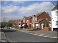
Area Overview for NG16 6QL
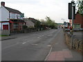
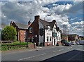
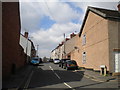
Photos of NG16 6QL


Area Information
NG16 6QL is a small, tightly knit residential cluster in England, covering 8,112 square metres and home to 1,421 residents. Its compact size fosters a close-knit community, with a population density of 1,238 people per square kilometre. The area is predominantly inhabited by adults aged 30–64, with a median age of 47, reflecting a mature, stable demographic. Over three-quarters of residents own their homes, with houses being the primary accommodation type. This suggests a long-term presence of families and professionals seeking a quieter, established environment. Daily life here is shaped by proximity to essential services, including retail outlets and rail links, while the low crime risk score of 68 indicates a generally safe living environment. The area’s small footprint means it is not a sprawling suburb but a focused, self-contained neighbourhood. For those prioritising security, convenience, and a settled community, NG16 6QL offers a compelling blend of practicality and tranquillity. Its location near educational institutions and transport hubs further enhances its appeal for families and commuters alike.
- Area Type
- Postcode
- Area Size
- 8112 m²
- Population
- 1421
- Population Density
- 1238 people/km²
The property market in NG16 6QL is characterised by a strong emphasis on owner-occupation, with 76% of homes owned by residents. This suggests a stable, long-term market where property is not primarily a rental investment. The accommodation type is predominantly houses, which is unusual for areas with limited space, indicating a focus on single-family homes rather than multi-unit developments. Given the area’s small size—just 8,112 square metres—the housing stock is likely limited, making it a niche market for buyers seeking a specific type of property. The high home ownership rate also implies that the area is not heavily reliant on rental demand, which may affect property prices and availability. For buyers, this means a smaller pool of properties, potentially requiring a targeted search within the immediate vicinity. The compact nature of NG16 6QL also means that proximity to amenities and transport is a key consideration for those looking to purchase here.
House Prices in NG16 6QL
Showing 17 properties
| Address | Type | Beds | Baths | Last Sale Price | Last Sale Date | |
|---|---|---|---|---|---|---|
| 9 Lambcroft Road, Pinxton, NG16 6QL | Semi-detached | 2 | 1 | £150,000 | Feb 2025 | |
| 5 Lambcroft Road, Pinxton, NG16 6QL | Bungalow | 2 | 1 | £173,000 | Apr 2024 | |
| 19 Lambcroft Road, Pinxton, NG16 6QL | Bungalow | - | - | £165,000 | Sep 2021 | |
| 7 Lambcroft Road, Pinxton, NG16 6QL | Bungalow | - | - | £200,000 | Jul 2021 | |
| 27 Lambcroft Road, Pinxton, NG16 6QL | Bungalow | 2 | 1 | £105,000 | Feb 2019 | |
| 25 Lambcroft Road, Pinxton, NG16 6QL | Bungalow | - | - | £94,000 | Apr 2018 | |
| 11 Lambcroft Road, Pinxton, NG16 6QL | Semi-detached | 2 | - | £125,000 | Sep 2017 | |
| 17 Lambcroft Road, Pinxton, NG16 6QL | Bungalow | 2 | - | £80,000 | Sep 2013 | |
| 31 Lambcroft Road, Pinxton, NG16 6QL | Bungalow | - | - | £104,950 | Oct 2008 | |
| 1 Lambcroft Road, Pinxton, NG16 6QL | Semi-detached | - | - | £95,000 | Feb 2005 |
Energy Efficiency in NG16 6QL
The lifestyle in NG16 6QL is shaped by its proximity to essential amenities, including retail outlets such as Co-op Pinxton, M&S Mansfield, and Morrisons Daily. These shops provide a range of daily necessities, from groceries to household goods, ensuring convenience for residents. The area’s rail links, including Alfreton and Kirkby in Ashfield stations, offer access to broader regional networks, supporting both leisure and work-related travel. While the area itself is small, its connection to nearby towns enhances the availability of additional services. The presence of schools and retail options fosters a self-contained community, reducing the need for long commutes. The compact nature of NG16 6QL also means that amenities are closely clustered, promoting walkability and accessibility. For residents, this balance of local convenience and regional connectivity creates a practical, efficient lifestyle, particularly for families and commuters.
Amenities
Schools
The schools near NG16 6QL include John King Infant School, a primary school, and John King Infant Academy, an academy with an outstanding Ofsted rating. This combination offers families a range of educational options, from early years education to a high-performing academy. The presence of an academy with an outstanding rating is a significant draw for parents prioritising academic quality. The primary school caters to younger children, while the academy likely provides a broader curriculum for older students. The proximity of these institutions to the area ensures ease of access for residents, reducing commuting times for families. The mix of school types also allows for flexibility, with parents able to choose between a traditional primary school or a more specialised academy. This diversity in educational provision supports the area’s appeal to families seeking reliable, high-quality schooling for their children.
| Rank | School | Type | Entry gender | Ages |
|---|
Explore more schools in this area
Go to Schools tabDemographics
The community in NG16 6QL is predominantly composed of adults aged 30–64, making up the most common age range. With a median age of 47, the area reflects a mature population, often associated with long-term residency and family-oriented living. Home ownership is high, at 76%, indicating a stable housing market where most residents are likely to have invested in property. The accommodation type is primarily houses, suggesting a preference for single-family dwellings over flats or apartments. The predominant ethnic group is White, and while specific data on diversity is not provided, the absence of notable ethnic minority statistics implies a relatively homogenous demographic. The population density of 1,238 people per square kilometre is significant for such a small area, highlighting a compact, densely populated residential cluster. This density may influence local amenities and social interactions, creating a vibrant yet intimate community feel.
Household Size
Accommodation Type
Tenure
Ethnic Group
Religion
Household Composition
Age
Household Deprivation
NS-SEC
Explore more demographic insights in this area
Go to Demographics tabPlanning
Planning Constraints
- Flood RiskPremium
- Ramsar Wetland SitesPremium
- Area of Outstanding Natural BeautyPremium
- Protected Nature ReservePremium
- Protected WoodlandPremium