Area Overview for NG16 6PS
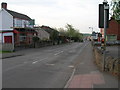
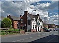
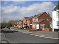
Photos of NG16 6PS


Area Information
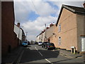
Living in NG16 6PS offers a compact, tightly knit residential experience. This small postcode area spans just 2.2 hectares, housing 1,421 residents in a densely populated setting. The community is predominantly composed of adults aged 30–64, with a median age of 47, suggesting a mature, stable population. Most homes are owner-occupied, with 76% of residents living in houses rather than flats. The area’s size and density create a close-knit environment, where daily life is shaped by proximity to essential services. Nearby amenities include retail outlets like Co-op Pinxton and Morrisons Daily, as well as multiple railway stations within practical reach. Schools such as John King Infant Academy, rated outstanding by Ofsted, are a key draw for families. While the area lacks natural or protected landscapes, its safety profile—low flood risk and below-average crime rates—makes it appealing for those prioritising security and practicality. NG16 6PS is a quiet, functional postcode, ideal for those seeking a settled lifestyle with easy access to transport and local services.
- Area Type
- Postcode
- Area Size
- 2.2 hectares
- Population
- 1421
- Population Density
- 1238 people/km²
NG16 6PS is characterised by a strong owner-occupied market, with 76% of homes owned by residents rather than rented. The accommodation type is predominantly houses, which is unusual for a small postcode area but may indicate a focus on family homes or semi-detached properties. This suggests a housing stock that prioritises privacy and space over high-density living. The limited size of the area—just 2.2 hectares—means the property market is likely constrained, with few new developments. Buyers should consider that the area’s compact nature may limit availability, though the high home ownership rate implies a stable market with fewer rental properties. For those seeking a home in NG16 6PS, the emphasis on owner-occupation and houses suggests a community-oriented environment, where properties are likely to remain in the same hands for extended periods. Proximity to rail links and local amenities further enhances the appeal for families or professionals requiring easy access to transport.
House Prices in NG16 6PS
Showing 21 properties
| Address | Type | Beds | Baths | Last Sale Price | Last Sale Date | |
|---|---|---|---|---|---|---|
| 90 Park Lane, Pinxton, NG16 6PS | Detached | 4 | 1 | £195,000 | Sep 2021 | |
| 88 Park Lane, Pinxton, NG16 6PS | Semi-detached | 3 | - | £134,000 | Nov 2020 | |
| 46 Park Lane, Pinxton, NG16 6PS | Semi-detached | 6 | 2 | £255,000 | Oct 2020 | |
| 76 Park Lane, Pinxton, NG16 6PS | Detached | 3 | - | £151,000 | Nov 2019 | |
| 86 Park Lane, Pinxton, NG16 6PS | Semi-detached | 2 | - | £99,000 | Aug 2017 | |
| 84 Park Lane, Pinxton, NG16 6PS | Semi-detached | 3 | - | £98,000 | Nov 2015 | |
| 80 Park Lane, Pinxton, NG16 6PS | house | - | - | £99,995 | Feb 2009 | |
| 78 Park Lane, Pinxton, NG16 6PS | Semi-detached | - | - | £89,995 | Jan 2006 | |
| 82 Park Lane, Pinxton, NG16 6PS | house | - | - | £99,995 | Aug 2005 | |
| Spion Kop Care Home, 72-74 Park Lane, Pinxton, NG16 6PS | hospital_care_home | - | - | £25,000 | May 2001 |
Energy Efficiency in NG16 6PS
The lifestyle in NG16 6PS is shaped by its proximity to essential retail and transport hubs. Nearby shops include Co-op Pinxton, Morrisons Daily, and Heron Hilcote, offering a range of grocery and everyday goods. These outlets cater to daily needs, reducing the necessity for long trips to larger centres. The five nearby railway stations—Alfreton, Kirkby in Ashfield, and Sutton Parkway—provide access to broader regional networks, supporting both local and long-distance travel. While the area lacks expansive parks or leisure facilities, the compact layout ensures amenities are within walking or short driving distance. The presence of schools and retail options fosters a self-contained community feel, where residents can meet daily needs without leaving the immediate vicinity. This convenience is balanced by the area’s small size, which may limit options for those seeking larger recreational spaces or cultural attractions.
Amenities
Schools
The schools near NG16 6PS include John King Infant School, a primary school serving younger children, and John King Infant Academy, an academy with an outstanding Ofsted rating. This combination of school types provides families with options for early education and potentially a broader curriculum as children progress. The presence of an outstanding-rated academy is a significant advantage, offering high-quality teaching and resources. However, the data does not specify secondary schools or further education facilities in the immediate area, which may require residents to travel to nearby postcodes. For families prioritising educational standards, the John King Infant Academy’s rating is a strong selling point, though parents should consider the availability of secondary schooling when evaluating long-term needs. The proximity of these schools to residential areas underscores the area’s appeal to households with children.
| Rank | School | Type | Entry gender | Ages |
|---|
Explore more schools in this area
Go to Schools tabDemographics
The demographic profile of NG16 6PS reflects a mature, largely White population. With a median age of 47, the area is dominated by adults aged 30–64, indicating a community with established careers and families. Home ownership is high, at 76%, with houses being the primary accommodation type. This suggests a stable, long-term resident base rather than a transient population. The predominant ethnic group is White, though specific data on diversity is not provided. The population density of 1,238 people per square kilometre highlights the area’s compact nature, which may influence social dynamics and community cohesion. While no deprivation data is explicitly stated, the high home ownership rate and presence of essential amenities suggest a relatively secure quality of life. The absence of younger demographics or significant ethnic diversity means the area is not a hub for cultural or generational diversity, but it offers a consistent, low-risk environment for residents.
Household Size
Accommodation Type
Tenure
Ethnic Group
Religion
Household Composition
Age
Household Deprivation
NS-SEC
Explore more demographic insights in this area
Go to Demographics tabPlanning
Planning Constraints
- Flood RiskPremium
- Ramsar Wetland SitesPremium
- Area of Outstanding Natural BeautyPremium
- Protected Nature ReservePremium
- Protected WoodlandPremium