Area Overview for NG16 6JA
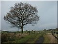
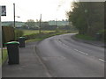
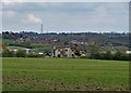
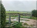
Photos of NG16 6JA
Area Information
NG16 6JA is a small residential postcode area in England, covering 1.1 km² with a population of 1653 people. Its compact size means it is a tight-knit community, with a population density of 298 people per square kilometre. The area is characterised by a mature demographic, with a median age of 47 and the majority of residents falling within the 30-64 age range. This suggests a stable, established community where many residents have lived for years. The area is predominantly home-owning, with 78% of properties owned by their occupants, and the accommodation is largely composed of houses rather than flats. Daily life in NG16 6JA is likely to revolve around local amenities, with nearby shops, schools, and transport links providing essential services. The low flood risk and below-average crime rates further contribute to a sense of security. While the area is small, its proximity to larger towns like Mansfield and Alfreton offers access to broader opportunities without the need to commute far. For those seeking a quiet, settled place to live with a balance of convenience and safety, NG16 6JA presents a compelling option.
- Area Type
- Postcode
- Area Size
- 1.1 km²
- Population
- 1653
- Population Density
- 298 people/km²
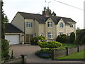
The property market in NG16 6JA is dominated by owner-occupied homes, with 78% of properties owned by their residents. This high home ownership rate suggests a stable and established market, where properties are likely to hold value over time. The accommodation is primarily houses rather than flats, which is typical of smaller, less urbanised postcode areas. This housing stock may appeal to families or individuals seeking more space and privacy, as opposed to the density of city centres. The small size of the area—just 1.1 km²—means that the housing stock is limited, and the immediate surroundings may offer similar characteristics. For buyers, this could mean a competitive market with limited new developments, but also the potential for long-term security in a low-risk environment. The absence of planning constraints such as protected woodlands or Areas of Outstanding Natural Beauty may also make the area more attractive for those seeking to build or renovate.
House Prices in NG16 6JA
Showing 60 properties
| Address | Type | Beds | Baths | Last Sale Price | Last Sale Date | |
|---|---|---|---|---|---|---|
| Shire Carr Farm House, Kirkby Lane, Pinxton, NG16 6JA | house | - | - | £859,999 | May 2023 | |
| Roselyn, Kirkby Lane, Pinxton, NG16 6JA | Bungalow | - | - | £290,000 | Jun 2021 | |
| Silver Maize, Kirkby Lane, Pinxton, NG16 6JA | Bungalow | 3 | 1 | £228,000 | Oct 2020 | |
| 2, Cliff Farm Cottages, Kirkby Lane, Pinxton, NG16 6JA | Semi-detached | - | - | £105,000 | Dec 1999 | |
| Langton Lodge, Kirkby Lane, Pinxton, NG16 6JA | house | 3 | - | - | - | |
| 1, Cliff Farm Cottages, Kirkby Lane, Pinxton, NG16 6JA | Semi-detached | - | - | - | - | |
| The Bungalow, Kirkby Lane, Pinxton, NG16 6JA | Detached | - | - | - | - | |
| Hazeldene, Kirkby Lane, Pinxton, NG16 6JA | Bungalow | 3 | 1 | - | - | |
| Langton Bungalow, Kirkby Lane, Pinxton, NG16 6JA | house | - | - | - | - | |
| Langton Hall, Kirkby Lane, Pinxton, NG16 6JA | Detached | - | - | - | - |
Energy Efficiency in NG16 6JA
The lifestyle in NG16 6JA is shaped by its proximity to nearby amenities, including retail outlets and transport hubs. Within practical reach are shops such as Co-op Pinxton, M&S Mansfield, and Spar, offering everyday shopping needs. These retail options are likely to serve both local residents and those from surrounding areas, contributing to a sense of convenience. The area’s rail connections, including Kirkby in Ashfield and Alfreton stations, provide access to broader regional networks, facilitating travel to work, leisure, or social activities. While the data does not mention parks or leisure facilities directly, the absence of environmental constraints like protected woodlands or AONBs suggests that open spaces may be limited. However, the low population density and small area size imply that residents may have access to nearby green spaces in surrounding towns. The combination of retail, transport, and community-focused infrastructure supports a lifestyle that balances local convenience with regional connectivity.
Amenities
Schools
The nearest school to NG16 6JA is Orchard Primary School and Nursery, which has an Ofsted rating of 'good'. This is the only school listed in the data, indicating that the area has limited educational options for primary-level students. The presence of a primary school suggests that the community is family-oriented, with children attending local schools rather than commuting to larger towns. However, the absence of secondary schools or other educational institutions within the area means that families may need to travel to nearby towns like Mansfield or Alfreton for further education. The 'good' Ofsted rating indicates that the school meets acceptable standards, but it does not provide specific details on academic performance or facilities. For prospective homebuyers, the availability of a primary school is a key consideration, though the lack of additional schools may require careful planning for long-term family needs.
| Rank | School | Type | Entry gender | Ages |
|---|
Explore more schools in this area
Go to Schools tabDemographics
The community in NG16 6JA is predominantly composed of adults aged 30-64, with a median age of 47. This reflects a mature population, likely with long-term ties to the area. Home ownership is high, at 78%, indicating a stable housing market where most residents are not renters. The accommodation is largely houses, which is typical of smaller rural or semi-rural postcode areas. The predominant ethnic group is White, which aligns with broader demographic trends in the region. The population density of 298 people per km² suggests a low-density, spread-out settlement pattern, with homes likely spaced apart rather than in high-rise or densely packed developments. The age profile and home ownership figures imply a community with a strong sense of continuity, where many residents have raised families or built careers over decades. There is no specific data on deprivation levels, but the low crime risk and absence of environmental constraints suggest a relatively high quality of life for residents.
Household Size
Accommodation Type
Tenure
Ethnic Group
Religion
Household Composition
Age
Household Deprivation
NS-SEC
Explore more demographic insights in this area
Go to Demographics tabPlanning
Planning Constraints
- Flood RiskPremium
- Ramsar Wetland SitesPremium
- Area of Outstanding Natural BeautyPremium
- Protected Nature ReservePremium
- Protected WoodlandPremium