Area Overview for NG16 6GT
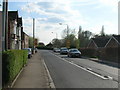
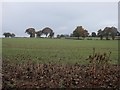
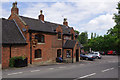
Photos of NG16 6GT
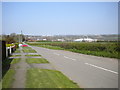
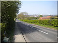
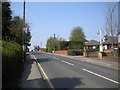
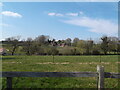
Area Information
NG16 6GT is a small, tightly packed residential cluster in England, covering 6,425 square metres and home to 1,841 people. Its compact size means the area feels cohesive, with a population density of 981 people per square kilometre. This postcode is defined by a mature demographic, with a median age of 47 and a strong presence of adults aged 30–64. The community is predominantly owner-occupied, with 86% of homes owned by residents, and most properties are houses rather than flats. This suggests a stable, long-term population with a focus on family living. Daily life in NG16 6GT is shaped by its proximity to local amenities, schools, and transport links, making it a practical choice for those seeking a balance between suburban comfort and accessibility. The area’s small footprint means it is likely surrounded by similar residential clusters, creating a network of connected but distinct neighbourhoods. For buyers, the appeal lies in its compactness, strong community ties, and the availability of essential services within walking or short driving distance.
- Area Type
- Postcode
- Area Size
- 6425 m²
- Population
- 1841
- Population Density
- 981 people/km²
The property market in NG16 6GT is characterised by high home ownership, with 86% of properties owned by residents rather than rented. This indicates a community of long-term occupants, many of whom are likely to be families or professionals seeking stable, low-maintenance housing. The predominant accommodation type is houses, not flats, which suggests a focus on single-family homes and larger properties. This makes the area appealing to buyers prioritising space and privacy over urban density. Given the small size of the postcode, the housing stock is likely limited to a few hundred properties, meaning the market is not vast but could be competitive for those seeking specific features. The high ownership rate also implies a lower turnover of properties, which may benefit buyers looking for a stable investment or a place to settle long-term.
House Prices in NG16 6GT
Showing 14 properties
| Address | Type | Beds | Baths | Last Sale Price | Last Sale Date | |
|---|---|---|---|---|---|---|
| 15 Pennine Drive, Selston, NG16 6GT | Bungalow | - | - | £159,000 | Jul 2022 | |
| 22 Pennine Drive, Selston, NG16 6GT | Bungalow | 4 | 2 | £303,000 | Jul 2022 | |
| 7 Pennine Drive, Selston, NG16 6GT | Bungalow | - | - | £123,000 | Nov 2010 | |
| 5 Pennine Drive, Selston, NG16 6GT | Detached | - | - | £124,000 | Mar 2007 | |
| 20 Pennine Drive, Selston, NG16 6GT | Bungalow | - | - | £151,000 | Feb 2007 | |
| 16 Pennine Drive, Selston, NG16 6GT | Detached | - | - | £115,000 | Nov 2006 | |
| 11 Pennine Drive, Selston, NG16 6GT | Detached | - | - | £112,000 | Feb 2006 | |
| 17 Pennine Drive, Selston, NG16 6GT | Detached | - | - | £46,000 | Jul 2000 | |
| 25 Pennine Drive, Selston, NG16 6GT | Detached | - | - | - | - | |
| 21 Pennine Drive, Selston, NG16 6GT | Detached | - | - | - | - |
Energy Efficiency in NG16 6GT
The lifestyle in NG16 6GT is shaped by its proximity to essential amenities, including retail, transport, and community hubs. Local shops such as Co-op Selston, Co-op Pinxton, and Co-op Jacksdale provide everyday convenience, while nearby rail stations and the Butler’s Hill Tram Stop ensure easy access to broader networks. Though the area is small, its amenities are practical for daily needs, with no indication of major leisure or recreational facilities. The presence of multiple retail outlets suggests a focus on local commerce, which may foster a sense of community. For residents, the balance of local shops and transport links means daily life is manageable without long commutes. The area’s compact nature ensures that amenities are within reach, though it may lack the diversity of larger urban centres.
Amenities
Schools
NG16 6GT is served by a mix of primary schools and academies, offering families multiple educational options. Selston CofE Infant and Nursery School and Selston Church of England Infant and Nursery School are both academies with Ofsted ratings of ‘good’, providing high-quality early education. Selston High School, listed twice in the data, operates as both a primary school and an academy, though its exact focus is unclear. The presence of two academies with ‘good’ ratings suggests a commitment to educational standards, while the variety of school types allows parents to choose between traditional and academically focused institutions. For families, this mix ensures access to well-regarded primary education without the need to travel far. The proximity of these schools to the area reinforces its appeal as a family-friendly location.
| Rank | School | Type | Entry gender | Ages |
|---|
Explore more schools in this area
Go to Schools tabDemographics
The population of NG16 6GT is predominantly composed of adults aged 30–64, with a median age of 47. This suggests a mature, settled community with a focus on long-term residency. Home ownership is exceptionally high at 86%, indicating a stable housing market and a population less reliant on rental properties. The majority of homes are houses, not flats, which aligns with the area’s family-oriented profile. Ethnically, the population is overwhelmingly White, though no specific data on diversity or minority representation is provided. The high population density of 981 people per square kilometre reflects the area’s compact nature, which may foster a close-knit community but could also mean limited space for expansion. For buyers, this demographic profile suggests a neighbourhood prioritising stability and continuity, with residents likely to be professionals, retirees, or families seeking a quiet, established environment.
Household Size
Accommodation Type
Tenure
Ethnic Group
Religion
Household Composition
Age
Household Deprivation
NS-SEC
Explore more demographic insights in this area
Go to Demographics tabPlanning
Planning Constraints
- Flood RiskPremium
- Ramsar Wetland SitesPremium
- Area of Outstanding Natural BeautyPremium
- Protected Nature ReservePremium
- Protected WoodlandPremium