Area Overview for NG16 6AU
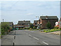
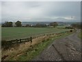
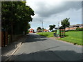
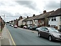
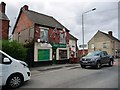
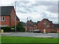
Photos of NG16 6AU

Area Information
NG16 6AU is a small, densely populated residential cluster in England, covering just 1.7 hectares and home to 1,677 people. Despite its compact size, the area offers a mix of everyday convenience and proximity to essential services. The high population density—over 101,551 people per square kilometre—suggests a tightly knit community, though the area’s small footprint means it is best suited for those prioritising accessibility over space. Residents are likely to find daily life centred around local amenities, with schools, shops, and transport links within walking or short driving distance. The area’s proximity to rail networks and a tram stop adds to its connectivity, making it a practical choice for commuters. While the demographic data shows a mature population with a median age of 47, the presence of a primary school with a good Ofsted rating indicates families are also part of the local fabric. Living here means embracing a compact, well-serviced environment where practicality and community needs are prioritised.
- Area Type
- Postcode
- Area Size
- 1.7 hectares
- Population
- 1677
- Population Density
- 3016 people/km²
The property market in NG16 6AU is characterised by a high rate of home ownership—63%—with houses being the predominant accommodation type. This suggests a market skewed towards owner-occupied properties rather than rental units, which may appeal to buyers seeking long-term stability. The small area size and high population density imply limited scope for new developments, meaning the housing stock is likely to remain relatively static. For buyers, this could mean a competitive market with limited options, but the presence of established homes may offer value for those prioritising security and proximity to amenities. The absence of large-scale commercial or industrial land use further reinforces the residential focus, making the area attractive for those seeking a compact, well-serviced living environment.
House Prices in NG16 6AU
Showing 30 properties
| Address | Type | Beds | Baths | Last Sale Price | Last Sale Date | |
|---|---|---|---|---|---|---|
| 8 Portland Road, Selston, NG16 6AU | Semi-detached | 2 | 1 | £155,000 | Dec 2024 | |
| 20 Portland Road, Selston, NG16 6AU | Detached | 4 | 3 | £335,000 | Feb 2024 | |
| 22 Portland Road, Selston, NG16 6AU | Semi-detached | 3 | 2 | £245,000 | Sep 2022 | |
| 18 Portland Road, Selston, NG16 6AU | house | - | - | £210,000 | Sep 2021 | |
| 32 Portland Road, Selston, NG16 6AU | house | - | - | £224,500 | Sep 2021 | |
| 30 Portland Road, Selston, NG16 6AU | Semi-detached | 3 | - | £223,500 | Aug 2021 | |
| 52 Portland Road, Selston, NG16 6AU | house | - | - | £125,000 | Dec 2020 | |
| 42 Portland Road, Selston, NG16 6AU | Terraced | 3 | - | £110,000 | May 2020 | |
| 12 Portland Road, Selston, NG16 6AU | Detached | 5 | - | £390,000 | Jul 2016 | |
| 2 Portland Road, Selston, NG16 6AU | house | - | - | £230,000 | May 2012 |
Energy Efficiency in NG16 6AU
The lifestyle in NG16 6AU is shaped by its proximity to essential retail and transport hubs. Within practical reach are five retail outlets, including Co-op stores in Selston, Pinxton, and Skegby, offering everyday shopping needs. The area’s rail network, with stations like Kirkby in Ashfield and Sutton Parkway, provides links to broader regional transport, while Butler’s Hill Tram Stop adds local connectivity. Though the data does not specify parks or leisure facilities, the presence of multiple retail and transport options suggests a practical, service-oriented lifestyle. Residents can access basic amenities without long commutes, though those seeking extensive leisure or green spaces may need to look further afield.
Amenities
Schools
The nearest school to NG16 6AU is Holly Hill Primary and Nursery School, which serves the local community with a primary education offering. It holds a good Ofsted rating, indicating a satisfactory standard of teaching and facilities. While no secondary schools are listed in the data, the presence of a primary school with a positive rating suggests that families with young children can access quality education within the area. The absence of further school details means that buyers should consider whether additional educational options are available nearby, though the existing provision appears adequate for early years education.
| Rank | School | Type | Entry gender | Ages |
|---|
Explore more schools in this area
Go to Schools tabDemographics
The community in NG16 6AU is predominantly composed of adults aged 30–64, with a median age of 47. This suggests a stable population with a focus on established households rather than younger families or retirees. Home ownership is high, at 63%, indicating a strong presence of long-term residents. The accommodation types are primarily houses, which aligns with the area’s residential character. The predominant ethnic group is White, though no specific data on diversity or deprivation is provided. The high proportion of owner-occupied homes suggests a degree of economic stability, though the lack of detailed diversity metrics means broader social dynamics remain unexplored. For buyers, this profile points to a mature, settled community where property is likely to be held for the long term.
Household Size
Accommodation Type
Tenure
Ethnic Group
Religion
Household Composition
Age
Household Deprivation
NS-SEC
Explore more demographic insights in this area
Go to Demographics tabPlanning
Planning Constraints
- Flood RiskPremium
- Ramsar Wetland SitesPremium
- Area of Outstanding Natural BeautyPremium
- Protected Nature ReservePremium
- Protected WoodlandPremium