Area Overview for NG16 6AN
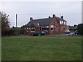
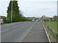
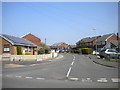
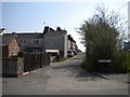
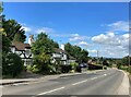
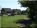
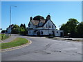
Photos of NG16 6AN

Area Information
NG16 6AN is a compact residential postcode in England, covering just 3.8 hectares and home to 1,677 residents. Its high population density—43,625 people per square kilometre—reflects a tightly knit community. The area’s small footprint means it is ideal for those seeking proximity to local amenities without the sprawl of larger towns. Daily life here is shaped by its mix of mature residents and family households, with a median age of 47 and a majority of adults aged 30–64. The presence of Holly Hill Primary and Nursery School, rated ‘good’ by Ofsted, underscores the area’s appeal to families. Nearby rail and tram links, including Kirkby in Ashfield and Butler’s Hill stations, provide easy access to surrounding regions. While the area lacks large-scale commercial hubs, its proximity to multiple Co-ops and transport nodes ensures convenience for everyday needs. Living in NG16 6AN balances quiet residential character with practical connectivity, making it a viable choice for those prioritising community and accessibility.
- Area Type
- Postcode
- Area Size
- 3.8 hectares
- Population
- 1677
- Population Density
- 3016 people/km²
NG16 6AN is primarily an owner-occupied area, with 63% of residents living in their own homes. The accommodation type is predominantly houses, not flats or apartments, which aligns with the area’s traditional, low-density character. Given the small size of the postcode—just 3.8 hectares—the housing stock is limited, meaning buyers must consider nearby areas for more options. The focus on owner-occupied properties suggests a stable market with long-term residents rather than a high turnover of rental properties. For those seeking homes in NG16 6AN, the challenge lies in the area’s compact nature, which may restrict availability. However, the proximity to rail and tram links, including Sutton Parkway and Moor Bridge stops, makes it attractive for commuters. Buyers should also consider the surrounding regions for broader choices, though the immediate area offers a quiet, established residential environment.
House Prices in NG16 6AN
Showing 14 properties
| Address | Type | Beds | Baths | Last Sale Price | Last Sale Date | |
|---|---|---|---|---|---|---|
| 158 Portland Road, Selston, NG16 6AN | Semi-detached | 3 | 1 | £186,000 | Mar 2025 | |
| Millington Springs Nursing Home, 160 Portland Road, Selston, NG16 6AN | hospital_care_home | - | - | £540,000 | Feb 2017 | |
| 164 Portland Road, Selston, NG16 6AN | Detached | - | - | £498,000 | Oct 2008 | |
| 142 Portland Road, Selston, NG16 6AN | house | - | - | - | - | |
| 152 Portland Road, Selston, NG16 6AN | Semi-detached | - | - | - | - | |
| 154 Portland Road, Selston, NG16 6AN | house | - | - | - | - | |
| 148 Portland Road, Selston, NG16 6AN | house | - | - | - | - | |
| 140 Portland Road, Selston, NG16 6AN | Semi-detached | - | - | - | - | |
| 136 Portland Road, Selston, NG16 6AN | Bungalow | - | - | - | - | |
| 150 Portland Road, Selston, NG16 6AN | house | - | - | - | - |
Energy Efficiency in NG16 6AN
The lifestyle in NG16 6AN is shaped by its proximity to essential amenities within practical reach. Five retail outlets, including Co-ops in Selston, Skegby, and Pinxton, provide everyday shopping convenience. The area’s rail and tram links, such as Sutton Parkway and Moor Bridge stations, offer access to broader regional networks, supporting both daily commutes and leisure travel. While the area lacks large leisure facilities, its small size means residents can access nearby towns for additional options. The presence of multiple retail points ensures basic needs are met locally, reducing the need for long trips. The community’s compact nature fosters a sense of familiarity, with local shops and transport hubs forming the backbone of daily life. For those valuing convenience and accessibility, NG16 6AN offers a balance of practicality and proximity to services.
Amenities
Schools
The nearest school to NG16 6AN is Holly Hill Primary and Nursery School, which serves the area’s younger residents. Rated ‘good’ by Ofsted, it provides a solid foundation for primary education. While no secondary schools are listed in the data, the presence of a primary school with a strong rating is a significant draw for families. The school’s proximity ensures ease of access for parents and children, reducing reliance on long commutes. However, families requiring secondary education may need to look beyond NG16 6AN, as the area does not include secondary schools within its immediate vicinity. This mix of school types—only primary—means the area caters to younger children but may not fully meet the needs of older students. For buyers prioritising schools, the quality of Holly Hill Primary is a clear advantage, though secondary options require additional research.
| Rank | School | Type | Entry gender | Ages |
|---|
Explore more schools in this area
Go to Schools tabDemographics
The population of NG16 6AN skews towards adults aged 30–64, with a median age of 47. This suggests a community of established professionals and families, rather than a younger demographic. Home ownership is strong, with 63% of residents owning their homes, indicating stability and long-term residency. The area is predominantly occupied by houses, not flats, reflecting a traditional housing stock. The predominant ethnic group is White, though no specific data on diversity or deprivation levels is provided. The high population density—43,625 people per square kilometre—means the area is densely populated for its size, which can influence local dynamics. For buyers, this density implies a mature, settled community with well-established services, though it may also mean limited space for expansion. The age profile suggests a balance between active professionals and retirees, creating a mix of needs in terms of amenities and infrastructure.
Household Size
Accommodation Type
Tenure
Ethnic Group
Religion
Household Composition
Age
Household Deprivation
NS-SEC
Explore more demographic insights in this area
Go to Demographics tabPlanning
Planning Constraints
- Flood RiskPremium
- Ramsar Wetland SitesPremium
- Area of Outstanding Natural BeautyPremium
- Protected Nature ReservePremium
- Protected WoodlandPremium