Area Overview for NG16 5QE
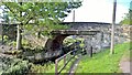
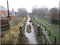
Photos of NG16 5QE


Area Information
NG16 5QE is a compact residential postcode in England, covering just 3,705 square metres and home to 1,476 residents. Its high population density of 1,217 people per square kilometre reflects a tightly knit community, though the area remains small enough to feel intimate. The postcode is part of a cluster of homes, with a strong presence of owner-occupied properties, though 31% of residents rent. Daily life here is shaped by proximity to essential services, including nearby rail stations and a primary school. The area’s compact nature means residents can access amenities within short distances, though its small size also limits expansion. While the community is largely composed of adults aged 30–64, the median age of 47 suggests a mature demographic. Living here offers convenience but requires consideration of local challenges, such as flood risk and crime rates, which are critical factors for prospective buyers.
- Area Type
- Postcode
- Area Size
- 3705 m²
- Population
- 1476
- Population Density
- 1217 people/km²
The property market in NG16 5QE is defined by a 31% home ownership rate, indicating that the majority of residents rent their homes. The area is primarily composed of houses, which are more common than flats or apartments. This suggests a housing stock suited to families or individuals seeking larger living spaces. Given the small size of the postcode, the market is likely limited in scope, with properties concentrated in a compact cluster. Buyers should consider the local dynamics: a lower proportion of owner-occupied homes may mean higher competition for available properties. The predominance of houses could appeal to those prioritising space and privacy, though the small area may restrict opportunities for expansion or development. Prospective buyers should also factor in local challenges, such as flood risk, when evaluating long-term viability.
House Prices in NG16 5QE
Showing 7 properties
| Address | Type | Beds | Baths | Last Sale Price | Last Sale Date | |
|---|---|---|---|---|---|---|
| 7 Deepdale, Ironville, NG16 5QE | Terraced | 3 | - | £65,000 | Jul 2018 | |
| 1 Deepdale, Ironville, NG16 5QE | house | 3 | 1 | - | - | |
| 11 Deepdale, Ironville, NG16 5QE | house | - | - | - | - | |
| 15 Deepdale, Ironville, NG16 5QE | house | - | - | - | - | |
| 9 Deepdale, Ironville, NG16 5QE | house | - | - | - | - | |
| 5 Deepdale, Ironville, NG16 5QE | house | - | - | - | - | |
| 3 Deepdale, Ironville, NG16 5QE | house | - | - | - | - |
Energy Efficiency in NG16 5QE
The lifestyle in NG16 5QE is shaped by its proximity to essential amenities. Retail options include Co-op Jacksdale, Heron Greenhill, and Co-op Leabrooks, offering everyday shopping needs within easy reach. These local stores cater to daily essentials, reducing the need for long trips. The area’s rail stations—Alfreton, Langley Mill, and Kirkby in Ashfield—provide access to broader regional networks, enhancing mobility for work or leisure. While the data does not mention parks or leisure facilities, the compact nature of the postcode suggests that residents may rely on nearby towns for recreational activities. The presence of a primary school and multiple retail points indicates a community focused on practicality and accessibility, though the lack of detailed information on green spaces or cultural amenities leaves room for further exploration.
Amenities
Schools
The nearest school to NG16 5QE is Ironville and Codnor Park Primary School, which serves the area’s younger residents. This primary school holds an Ofsted rating of ‘good’, indicating a satisfactory standard of education. The presence of a primary school within practical reach is a key consideration for families, though the absence of secondary schools or further education institutions means parents may need to look beyond the immediate area for comprehensive schooling. The single school listed reflects a focus on primary education, which may suit households with young children but could be a limitation for those requiring secondary schooling. The quality of the primary school, combined with the area’s compact size, suggests a community that prioritises accessible education for younger children.
| Rank | School | Type | Entry gender | Ages |
|---|
Explore more schools in this area
Go to Schools tabDemographics
The population of NG16 5QE is predominantly adults aged 30–64, making up the most common age range. With a median age of 47, the community is mature, though not elderly. Home ownership is relatively low at 31%, indicating a significant proportion of residents rent their homes. The area is characterised by houses rather than flats, reflecting a traditional housing stock. The predominant ethnic group is White, though no specific diversity figures are provided. The demographic profile suggests a stable, middle-aged population with established roots. The low home ownership rate may indicate a rental market dominated by long-term tenants or a mix of owner-occupiers and renters. The absence of detailed deprivation data means quality of life factors remain unquantified, but the age profile and housing type suggest a community focused on settled, family-oriented living.
Household Size
Accommodation Type
Tenure
Ethnic Group
Religion
Household Composition
Age
Household Deprivation
NS-SEC
Explore more demographic insights in this area
Go to Demographics tabPlanning
Planning Constraints
- Flood RiskPremium
- Ramsar Wetland SitesPremium
- Area of Outstanding Natural BeautyPremium
- Protected Nature ReservePremium
- Protected WoodlandPremium