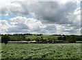
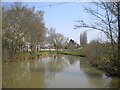
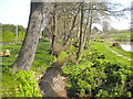
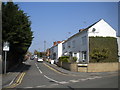
Area Overview for NG16 5JB
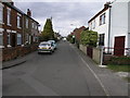
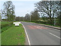
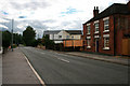
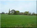
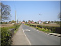
Photos of NG16 5JB

Area Information
NG16 5JB is a small, compact residential postcode in England, covering just 2.5 hectares and home to 1383 people. Its high population density of 633 people per square kilometre reflects a tightly knit community, where daily life is shaped by proximity to local amenities and a focus on practical living. The area’s size means it is not sprawling, but its density ensures that essential services are within easy reach. Residents here are predominantly adults aged 30-64, with a median age of 47, suggesting a mature, settled population. The area’s character is defined by its quiet, residential nature, with homes rather than apartments dominating the housing stock. While it lacks the vibrancy of larger urban centres, its simplicity and accessibility make it appealing for those prioritising stability and convenience. The presence of nearby rail links and a tram stop, combined with strong broadband connectivity, ensures that even in this small cluster, modern living needs are met. For those seeking a compact, community-focused environment without the noise of a city, NG16 5JB offers a straightforward, no-frills alternative.
- Area Type
- Postcode
- Area Size
- 2.5 hectares
- Population
- 1383
- Population Density
- 633 people/km²
The property market in NG16 5JB is dominated by owner-occupied homes, with 78% of residents owning their properties. This high rate of home ownership suggests a stable, long-term population rather than a transient rental market. The accommodation type is primarily houses, which is typical for smaller, rural or semi-rural postcodes. This contrasts with areas where flats or apartments are more common, and it may appeal to buyers seeking traditional family homes with garden space. The limited area size of 2.5 hectares means the housing stock is not extensive, and properties are likely to be closely spaced. For buyers, this implies that the area is not suited to those seeking a large selection of properties, but it may offer a sense of exclusivity or community cohesion. The focus on owner-occupation also means that rental availability is likely limited, and those considering a move may need to act quickly to secure a property. The market’s compact nature means that proximity to amenities and transport is a key selling point, as the area’s small size necessitates efficient use of space.
House Prices in NG16 5JB
Showing 16 properties
| Address | Type | Beds | Baths | Last Sale Price | Last Sale Date | |
|---|---|---|---|---|---|---|
| 209 Main Road, Jacksdale, NG16 5JB | Bungalow | - | - | £279,950 | Nov 2021 | |
| The Hawthornes, 217 Main Road, Jacksdale, NG16 5JB | house | - | - | £390,000 | Nov 2012 | |
| 215 Main Road, Jacksdale, NG16 5JB | house | - | - | £390,000 | Oct 2012 | |
| 213 Main Road, Jacksdale, NG16 5JB | Semi-detached | 3 | 1 | £410,000 | Aug 2012 | |
| 233 Main Road, Jacksdale, NG16 5JB | Semi-detached | - | - | £130,000 | Apr 2006 | |
| 227 Main Road, Jacksdale, NG16 5JB | Semi-detached | - | - | £126,000 | Nov 2004 | |
| 219 Main Road, Jacksdale, NG16 5JB | Semi-detached | 3 | - | - | - | |
| 235 Main Road, Jacksdale, NG16 5JB | Semi-detached | - | - | - | - | |
| Selkirk, 221A Main Road, Jacksdale, NG16 5JB | Detached | - | - | - | - | |
| 211 Main Road, Jacksdale, NG16 5JB | house | - | - | - | - |
Energy Efficiency in NG16 5JB
The lifestyle in NG16 5JB is shaped by its proximity to essential amenities. Within practical reach are five retail outlets, including Co-op stores in Jacksdale, Selston, and Pinxton, offering everyday shopping convenience. The area’s rail network is extensive, with five stations providing connections to nearby towns and cities, while the Butler’s Hill Tram Stop adds another layer of public transport access. Although the data does not specify parks or leisure facilities, the presence of multiple retail and transport options suggests a focus on practicality over leisure. The compact nature of the area means that residents can access these amenities without long commutes, fostering a self-contained community. The mix of retail and transport infrastructure supports a lifestyle that prioritises ease of access, though those seeking more extensive recreational facilities may need to venture further afield. The character of the area is defined by its simplicity and functional layout, appealing to those who value convenience over luxury.
Amenities
Schools
The nearest school to NG16 5JB is Westwood Infant and Nursery School, a primary school with a good Ofsted rating. This provides a reliable option for families with young children, though the absence of secondary schools in the data means that parents may need to look beyond the immediate area for secondary education. The presence of a primary school with a good rating is a positive indicator for families prioritising quality education, as it suggests a focus on early learning and development. However, the limited data on schools means that the full range of educational options is unclear. For those considering NG16 5JB, the availability of a rated primary school is a practical advantage, but the need for additional travel to access secondary schooling is a consideration. The school’s proximity to the area also reflects the community’s emphasis on accessibility, ensuring that children can attend without long commutes.
| Rank | School | Type | Entry gender | Ages |
|---|
Explore more schools in this area
Go to Schools tabDemographics
The population of NG16 5JB is predominantly adults aged 30-64, with a median age of 47. This suggests a community of established professionals and families, rather than students or retirees. Home ownership is high, with 78% of residents owning their homes, indicating a stable, long-term presence in the area. The accommodation type is primarily houses, which aligns with the area’s residential character and contributes to its lower population density compared to apartment-dominated zones. The predominant ethnic group is White, reflecting the broader demographic trends of the region. While no specific data on deprivation is provided, the high home ownership rate and moderate population size suggest a relatively self-sufficient community. The absence of significant diversity data means the area’s social fabric is likely homogenous, which may appeal to those seeking familiarity but could limit cultural variety. For buyers, this demographic profile implies a neighbourhood where neighbours are likely to be long-term residents, fostering a sense of continuity and shared local knowledge.
Household Size
Accommodation Type
Tenure
Ethnic Group
Religion
Household Composition
Age
Household Deprivation
NS-SEC
Explore more demographic insights in this area
Go to Demographics tabPlanning
Planning Constraints
- Flood RiskPremium
- Ramsar Wetland SitesPremium
- Area of Outstanding Natural BeautyPremium
- Protected Nature ReservePremium
- Protected WoodlandPremium