Area Overview for NG16 2GE
Photos of NG16 2GE
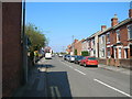
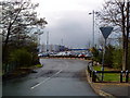


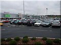
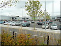

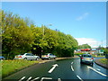

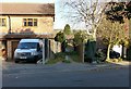
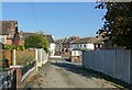
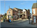
43 photos from this area
Area Information
Key information about the NG16 2GE including its size, population, and administrative classification.
- Area Type
- Postcode
- Area Size
- 2.1 hectares
- Population
- 1628
- Population Density
- 836 people/km²
House Prices in NG16 2GE
33
Properties
£151,825
Average Sold Price
£47,000
Lowest Price
£312,500
Highest Price
Showing 33 properties
| Address | Type | Beds | Baths | Last Sale Price | Last Sale Date | |
|---|---|---|---|---|---|---|
| 448 Nottingham Road, Giltbrook, NG16 2GE | Detached | 4 | 3 | £312,500 | May 2025 | |
| 466 Nottingham Road, Giltbrook, NG16 2GE | Detached | 3 | 1 | £280,000 | Mar 2025 | |
| 444A Nottingham Road, Giltbrook, NG16 2GE | Detached | 3 | 2 | £292,500 | Nov 2024 | |
| 456 Nottingham Road, Giltbrook, NG16 2GE | Detached | 3 | 1 | £170,000 | Mar 2016 | |
| 508 Nottingham Road, Giltbrook, NG16 2GE | Bungalow | 2 | 1 | £117,000 | Nov 2015 | |
| 460 Nottingham Road, Giltbrook, NG16 2GE | Semi-detached | 3 | - | £140,000 | Aug 2015 | |
| 464 Nottingham Road, Giltbrook, NG16 2GE | house | - | - | £138,100 | Aug 2014 | |
| 450A Nottingham Road, Giltbrook, NG16 2GE | Detached | 4 | 2 | £223,000 | Jun 2014 | |
| 472A Nottingham Road, Giltbrook, NG16 2GE | Bungalow | 3 | - | £128,000 | Aug 2009 | |
| 490 Nottingham Road, Giltbrook, NG16 2GE | house | 5 | 4 | £155,000 | Sep 2006 |
Page 1 of 4
Energy Efficiency in NG16 2GE
Amenities
Schools
| Rank | School | Type | Entry gender | Ages |
|---|
Explore more schools in this area
Go to Schools tabDemographics
Household Size
Two person
most common
Accommodation Type
Houses
most common
Tenure
90
majority
Ethnic Group
White
most common
Religion
N/A
most common
Household Composition
N/A
most common
Age
47
median
Adults (30-64 years)
most common
Household Deprivation
N/A
with no deprivation
NS-SEC
30
in Lower managerial occupations
Explore more demographic insights in this area
Go to Demographics tabPlanning
Planning Constraints
- Flood RiskPremium
- Ramsar Wetland SitesPremium
- Area of Outstanding Natural BeautyPremium
- Protected Nature ReservePremium
- Protected WoodlandPremium