Area Overview for NG16 1LB
Photos of NG16 1LB
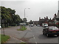
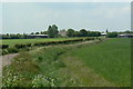
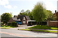
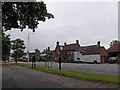
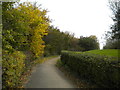
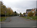
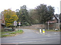
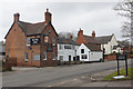
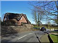
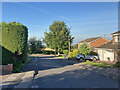

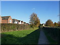
23 photos from this area
Area Information
Key information about the NG16 1LB including its size, population, and administrative classification.
- Area Type
- Postcode
- Area Size
- 2343 m²
- Population
- 1905
- Population Density
- 333 people/km²
House Prices in NG16 1LB
25
Properties
£110,055
Average Sold Price
£88,000
Lowest Price
£124,950
Highest Price
Showing 25 properties
| Address | Type | Beds | Baths | Last Sale Price | Last Sale Date | |
|---|---|---|---|---|---|---|
| 25, Riddles Court, Deeley Close, Watnall, NG16 1LB | Flat | 2 | 1 | £123,700 | Oct 2022 | |
| 19, Riddles Court, Deeley Close, Watnall, NG16 1LB | Flat | - | - | £96,000 | Apr 2021 | |
| 6, Riddles Court, Deeley Close, Watnall, NG16 1LB | Flat | 1 | 1 | £100,000 | Oct 2020 | |
| 1, Riddles Court, Deeley Close, Watnall, NG16 1LB | Flat | 2 | - | £103,000 | Mar 2019 | |
| 10, Riddles Court, Deeley Close, Watnall, NG16 1LB | Flat | 2 | 1 | £88,000 | Feb 2019 | |
| 26, Riddles Court, Deeley Close, Watnall, NG16 1LB | Flat | 2 | 1 | £100,000 | Oct 2016 | |
| 17, Riddles Court, Deeley Close, Watnall, NG16 1LB | Flat | 2 | 1 | £124,950 | Apr 2005 | |
| 5, Riddles Court, Deeley Close, Watnall, NG16 1LB | Flat | - | - | £124,950 | Feb 2005 | |
| 9, Riddles Court, Deeley Close, Watnall, NG16 1LB | Flat | 2 | 1 | £119,995 | Dec 2004 | |
| 15, Riddles Court, Deeley Close, Watnall, NG16 1LB | Flat | 2 | 1 | £119,950 | Sep 2004 |
Page 1 of 3
Energy Efficiency in NG16 1LB
Amenities
Schools
| Rank | School | Type | Entry gender | Ages |
|---|
Explore more schools in this area
Go to Schools tabDemographics
Household Size
Two person
most common
Accommodation Type
Houses
most common
Tenure
83
majority
Ethnic Group
White
most common
Religion
N/A
most common
Household Composition
N/A
most common
Age
47
median
Adults (30-64 years)
most common
Household Deprivation
N/A
with no deprivation
NS-SEC
45
in Lower managerial occupations
Explore more demographic insights in this area
Go to Demographics tabPlanning
Planning Constraints
- Flood RiskPremium
- Ramsar Wetland SitesPremium
- Area of Outstanding Natural BeautyPremium
- Protected Nature ReservePremium
- Protected WoodlandPremium