Area Overview for NG16 1AQ
Photos of NG16 1AQ
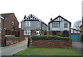
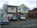
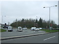
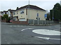
57 photos from this area
Area Information
Key information about the NG16 1AQ including its size, population, and administrative classification.
- Area Type
- Postcode
- Area Size
- 1.4 hectares
- Population
- 1441
- Population Density
- 4674 people/km²
House Prices in NG16 1AQ
51
Properties
£157,813
Average Sold Price
£34,500
Lowest Price
£327,500
Highest Price
Showing 51 properties
| Address | Type | Beds | Baths | Last Sale Price | Last Sale Date | |
|---|---|---|---|---|---|---|
| 45 Horsendale Avenue, Nuthall, NG16 1AQ | Flat | - | - | £327,500 | Oct 2024 | |
| 63 Horsendale Avenue, Nuthall, NG16 1AQ | Detached | 3 | 1 | £297,000 | Apr 2023 | |
| 53 Horsendale Avenue, Nuthall, NG16 1AQ | house | - | - | £250,000 | Jan 2022 | |
| 65 Horsendale Avenue, Nuthall, NG16 1AQ | house | - | - | £290,000 | Jun 2021 | |
| 75 Horsendale Avenue, Nuthall, NG16 1AQ | house | - | - | £250,000 | Jun 2021 | |
| 61 Horsendale Avenue, Nuthall, NG16 1AQ | Detached | 3 | 2 | £238,000 | Nov 2020 | |
| 57 Horsendale Avenue, Nuthall, NG16 1AQ | Detached | 3 | 2 | £198,000 | Aug 2018 | |
| 83 Horsendale Avenue, Nuthall, NG16 1AQ | house | - | - | £175,000 | Oct 2017 | |
| 29A Horsendale Avenue, Nuthall, NG16 1AQ | Maisonette | 2 | 1 | £85,000 | Aug 2017 | |
| 35 Horsendale Avenue, Nuthall, NG16 1AQ | Flat | 3 | - | £85,000 | Jul 2017 |
Page 1 of 6
Energy Efficiency in NG16 1AQ
Amenities
Schools
| Rank | School | Type | Entry gender | Ages |
|---|
Explore more schools in this area
Go to Schools tabDemographics
Household Size
Two person
most common
Accommodation Type
Houses
most common
Tenure
86
majority
Ethnic Group
White
most common
Religion
N/A
most common
Household Composition
N/A
most common
Age
47
median
Adults (30-64 years)
most common
Household Deprivation
N/A
with no deprivation
NS-SEC
39
in Lower managerial occupations
Explore more demographic insights in this area
Go to Demographics tabPlanning
Planning Constraints
- Flood RiskPremium
- Ramsar Wetland SitesPremium
- Area of Outstanding Natural BeautyPremium
- Protected Nature ReservePremium
- Protected WoodlandPremium