Area Overview for NG16 1AE
Photos of NG16 1AE
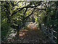
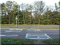
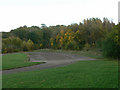
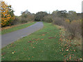
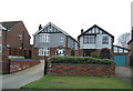
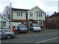
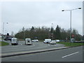
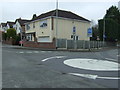
57 photos from this area
Area Information
Key information about the NG16 1AE including its size, population, and administrative classification.
- Area Type
- Postcode
- Area Size
- 3.7 hectares
- Population
- 1720
- Population Density
- 3185 people/km²
House Prices in NG16 1AE
36
Properties
£207,098
Average Sold Price
£53,500
Lowest Price
£540,000
Highest Price
Showing 36 properties
| Address | Type | Beds | Baths | Last Sale Price | Last Sale Date | |
|---|---|---|---|---|---|---|
| 161 Nottingham Road, Nuthall, NG16 1AE | Detached | 3 | 1 | £305,000 | Oct 2025 | |
| 183 Nottingham Road, Nuthall, NG16 1AE | Semi-detached | 4 | 2 | £320,000 | Mar 2025 | |
| 159 Nottingham Road, Nuthall, NG16 1AE | house | - | - | £275,000 | Feb 2025 | |
| 203 Nottingham Road, Nuthall, NG16 1AE | Detached | 3 | 1 | £223,000 | Apr 2022 | |
| 195 Nottingham Road, Nuthall, NG16 1AE | Detached | 3 | 1 | £267,000 | Dec 2021 | |
| 187A Nottingham Road, Nuthall, NG16 1AE | Detached | 4 | 5 | £540,000 | Feb 2019 | |
| 197 Nottingham Road, Nuthall, NG16 1AE | Detached | 3 | 1 | £195,000 | Feb 2016 | |
| 171 Nottingham Road, Nuthall, NG16 1AE | Semi-detached | 4 | - | £183,000 | Aug 2015 | |
| 193 Nottingham Road, Nuthall, NG16 1AE | Semi-detached | 3 | - | £174,000 | Oct 2014 | |
| 133 Nottingham Road, Nuthall, NG16 1AE | Detached | 3 | - | £152,000 | Mar 2014 |
Page 1 of 4
Energy Efficiency in NG16 1AE
Amenities
Schools
| Rank | School | Type | Entry gender | Ages |
|---|
Explore more schools in this area
Go to Schools tabDemographics
Household Size
Two person
most common
Accommodation Type
Houses
most common
Tenure
93
majority
Ethnic Group
White
most common
Religion
N/A
most common
Household Composition
N/A
most common
Age
47
median
Adults (30-64 years)
most common
Household Deprivation
N/A
with no deprivation
NS-SEC
39
in Lower managerial occupations
Explore more demographic insights in this area
Go to Demographics tabPlanning
Planning Constraints
- Flood RiskPremium
- Ramsar Wetland SitesPremium
- Area of Outstanding Natural BeautyPremium
- Protected Nature ReservePremium
- Protected WoodlandPremium