Area Overview for NG15 9FF
Photos of NG15 9FF
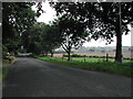
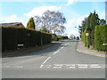
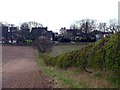
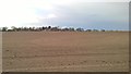
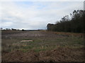
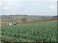
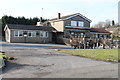
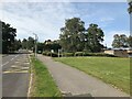
8 photos from this area
Area Information
Key information about the NG15 9FF including its size, population, and administrative classification.
- Area Type
- Postcode
- Area Size
- 5.3 hectares
- Population
- 1475
- Population Density
- 1323 people/km²
House Prices in NG15 9FF
49
Properties
£381,563
Average Sold Price
£90,000
Lowest Price
£1,425,000
Highest Price
Showing 49 properties
| Address | Type | Beds | Baths | Last Sale Price | Last Sale Date | |
|---|---|---|---|---|---|---|
| 18 Church Drive, Ravenshead, NG15 9FF | Bungalow | 5 | 6 | £1,425,000 | Mar 2025 | |
| 90 Church Drive, Ravenshead, NG15 9FF | Detached | 4 | 1 | £340,000 | Nov 2023 | |
| 56 Church Drive, Ravenshead, NG15 9FF | Detached | 4 | 1 | £490,000 | Aug 2023 | |
| 40 Church Drive, Ravenshead, NG15 9FF | Detached | 5 | 3 | £550,000 | Nov 2022 | |
| 80 Church Drive, Ravenshead, NG15 9FF | Retail | 5 | 3 | £570,000 | Jul 2022 | |
| 10 Church Drive, Ravenshead, NG15 9FF | house | 4 | 2 | £560,000 | May 2022 | |
| 72 Church Drive, Ravenshead, NG15 9FF | house | - | - | £350,000 | Apr 2021 | |
| 22 Church Drive, Ravenshead, NG15 9FF | Detached | 3 | 2 | £465,000 | Jul 2020 | |
| 70 Church Drive, Ravenshead, NG15 9FF | Detached | 4 | 1 | £365,000 | Jun 2019 | |
| 12 Church Drive, Ravenshead, NG15 9FF | Bungalow | 3 | 1 | £235,000 | Aug 2018 |
Page 1 of 5
Energy Efficiency in NG15 9FF
Amenities
Schools
| Rank | School | Type | Entry gender | Ages |
|---|
Explore more schools in this area
Go to Schools tabDemographics
Household Size
Two person
most common
Accommodation Type
Houses
most common
Tenure
92
majority
Ethnic Group
White
most common
Religion
N/A
most common
Household Composition
N/A
most common
Age
47
median
Elderly (65+ years)
most common
Household Deprivation
N/A
with no deprivation
NS-SEC
49
in Lower managerial occupations
Explore more demographic insights in this area
Go to Demographics tabPlanning
Planning Constraints
- Flood RiskPremium
- Ramsar Wetland SitesPremium
- Area of Outstanding Natural BeautyPremium
- Protected Nature ReservePremium
- Protected WoodlandPremium