Area Overview for NG15 8HS
Photos of NG15 8HS
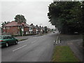
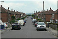
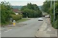
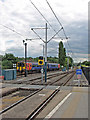

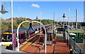
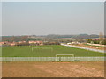
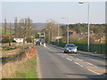
32 photos from this area
Area Information
Key information about the NG15 8HS including its size, population, and administrative classification.
- Area Type
- Postcode
- Area Size
- 2.8 hectares
- Population
- 1303
- Population Density
- 2344 people/km²
House Prices in NG15 8HS
72
Properties
£192,821
Average Sold Price
£115,000
Lowest Price
£342,500
Highest Price
Showing 72 properties
| Address | Type | Beds | Baths | Last Sale Price | Last Sale Date | |
|---|---|---|---|---|---|---|
| 323 Kenbrook Road, Hucknall, NG15 8HS | house | 4 | 1 | £342,500 | Jul 2025 | |
| 301 Kenbrook Road, Hucknall, NG15 8HS | house | 2 | 1 | £185,000 | May 2024 | |
| 319 Kenbrook Road, Hucknall, NG15 8HS | house | - | - | £260,000 | Oct 2023 | |
| 306 Kenbrook Road, Hucknall, NG15 8HS | Detached | 3 | 1 | £252,750 | Jul 2023 | |
| 322 Kenbrook Road, Hucknall, NG15 8HS | Retail | 4 | 2 | £255,000 | Jul 2022 | |
| 307 Kenbrook Road, Hucknall, NG15 8HS | house | - | - | £210,000 | Feb 2022 | |
| 275 Kenbrook Road, Hucknall, NG15 8HS | house | - | - | £300,000 | Jul 2021 | |
| 263 Kenbrook Road, Hucknall, NG15 8HS | house | - | - | £204,000 | Dec 2020 | |
| 308 Kenbrook Road, Hucknall, NG15 8HS | house | - | - | £152,000 | Oct 2020 | |
| Kenbrook House, 261 Kenbrook Road, Hucknall, NG15 8HS | Detached | 3 | 1 | £265,000 | Oct 2020 |
Page 1 of 8
Energy Efficiency in NG15 8HS
Amenities
Schools
| Rank | School | Type | Entry gender | Ages |
|---|
Explore more schools in this area
Go to Schools tabDemographics
Household Size
Family (3-5 people)
most common
Accommodation Type
Houses
most common
Tenure
84
majority
Ethnic Group
White
most common
Religion
N/A
most common
Household Composition
N/A
most common
Age
47
median
Adults (30-64 years)
most common
Household Deprivation
N/A
with no deprivation
NS-SEC
48
in Lower managerial occupations
Explore more demographic insights in this area
Go to Demographics tabPlanning
Planning Constraints
- Flood RiskPremium
- Ramsar Wetland SitesPremium
- Area of Outstanding Natural BeautyPremium
- Protected Nature ReservePremium
- Protected WoodlandPremium