Area Overview for NG15 8HN
Photos of NG15 8HN
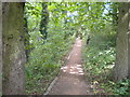
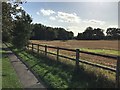
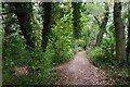
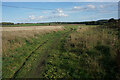
26 photos from this area
Area Information
Key information about the NG15 8HN including its size, population, and administrative classification.
- Area Type
- Postcode
- Area Size
- 9479 m²
- Population
- 1369
- Population Density
- 4596 people/km²
House Prices in NG15 8HN
22
Properties
£272,261
Average Sold Price
£200,000
Lowest Price
£370,000
Highest Price
Showing 22 properties
| Address | Type | Beds | Baths | Last Sale Price | Last Sale Date | |
|---|---|---|---|---|---|---|
| 27 Hobben Crescent, Hucknall, NG15 8HN | house | - | - | £345,000 | Nov 2021 | |
| 9 Hobben Crescent, Hucknall, NG15 8HN | Detached | 4 | 1 | £295,000 | Oct 2019 | |
| 16 Hobben Crescent, Hucknall, NG15 8HN | Detached | 3 | 2 | £250,000 | Oct 2019 | |
| 25 Hobben Crescent, Hucknall, NG15 8HN | Detached | 6 | 4 | £370,000 | Jun 2018 | |
| 2 Hobben Crescent, Hucknall, NG15 8HN | house | - | - | £240,000 | Jun 2015 | |
| 6 Hobben Crescent, Hucknall, NG15 8HN | house | - | - | £313,496 | Mar 2013 | |
| 29 Hobben Crescent, Hucknall, NG15 8HN | Detached | 5 | 3 | £279,995 | Sep 2012 | |
| 20 Hobben Crescent, Hucknall, NG15 8HN | house | - | - | £225,649 | Sep 2012 | |
| 24 Hobben Crescent, Hucknall, NG15 8HN | house | - | - | £235,000 | Jun 2012 | |
| 10 Hobben Crescent, Hucknall, NG15 8HN | house | - | - | £200,000 | Jun 2012 |
Page 1 of 3
Energy Efficiency in NG15 8HN
Amenities
Schools
| Rank | School | Type | Entry gender | Ages |
|---|
Explore more schools in this area
Go to Schools tabDemographics
Household Size
Family (3-5 people)
most common
Accommodation Type
Houses
most common
Tenure
66
majority
Ethnic Group
White
most common
Religion
N/A
most common
Household Composition
N/A
most common
Age
47
median
Adults (30-64 years)
most common
Household Deprivation
N/A
with no deprivation
NS-SEC
43
in Lower managerial occupations
Explore more demographic insights in this area
Go to Demographics tabPlanning
Planning Constraints
- Flood RiskPremium
- Ramsar Wetland SitesPremium
- Area of Outstanding Natural BeautyPremium
- Protected Nature ReservePremium
- Protected WoodlandPremium