Area Overview for NG15 8FL
Photos of NG15 8FL
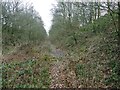
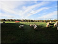
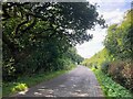
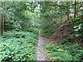
9 photos from this area
Area Information
Key information about the NG15 8FL including its size, population, and administrative classification.
- Area Type
- Postcode
- Area Size
- 2.0 km²
- Population
- 2712
- Population Density
- 122 people/km²
House Prices in NG15 8FL
31
Properties
£294,577
Average Sold Price
£83,000
Lowest Price
£640,000
Highest Price
Showing 31 properties
| Address | Type | Beds | Baths | Last Sale Price | Last Sale Date | |
|---|---|---|---|---|---|---|
| 183 Mansfield Road, Papplewick, NG15 8FL | Semi-detached | 3 | 1 | £285,000 | Feb 2025 | |
| 201 Mansfield Road, Papplewick, NG15 8FL | house | - | - | £390,000 | Dec 2024 | |
| The Dell, 175 Mansfield Road, Papplewick, NG15 8FL | Retail | - | - | £400,000 | Sep 2022 | |
| 149 Mansfield Road, Papplewick, NG15 8FL | Detached | 4 | 2 | £640,000 | Aug 2022 | |
| 143 Mansfield Road, Papplewick, NG15 8FL | Detached | 4 | 1 | £255,000 | Feb 2017 | |
| 187 Mansfield Road, Papplewick, NG15 8FL | Semi-detached | 3 | - | £188,000 | Nov 2015 | |
| 169 Mansfield Road, Papplewick, NG15 8FL | Land | 3 | - | £250,000 | Jun 2012 | |
| 199 Mansfield Road, Papplewick, NG15 8FL | house | 3 | 1 | £161,000 | Jul 2011 | |
| 191 Mansfield Road, Papplewick, NG15 8FL | house | - | - | £290,000 | Nov 2010 | |
| 195 Mansfield Road, Papplewick, NG15 8FL | Detached | - | - | £285,000 | May 2006 |
Page 1 of 4
Energy Efficiency in NG15 8FL
Amenities
Schools
| Rank | School | Type | Entry gender | Ages |
|---|
Explore more schools in this area
Go to Schools tabDemographics
Household Size
Two person
most common
Accommodation Type
Houses
most common
Tenure
76
majority
Ethnic Group
White
most common
Religion
N/A
most common
Household Composition
N/A
most common
Age
47
median
Adults (30-64 years)
most common
Household Deprivation
N/A
with no deprivation
NS-SEC
37
in Lower managerial occupations
Explore more demographic insights in this area
Go to Demographics tabPlanning
Planning Constraints
- Flood RiskPremium
- Ramsar Wetland SitesPremium
- Area of Outstanding Natural BeautyPremium
- Protected Nature ReservePremium
- Protected WoodlandPremium