Area Overview for NG15 7UT
Photos of NG15 7UT
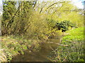
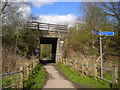
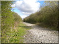
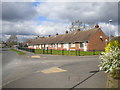
50 photos from this area
Area Information
Key information about the NG15 7UT including its size, population, and administrative classification.
- Area Type
- Postcode
- Area Size
- 1.2 hectares
- Population
- 2272
- Population Density
- 4640 people/km²
House Prices in NG15 7UT
54
Properties
£149,529
Average Sold Price
£60,500
Lowest Price
£340,000
Highest Price
Showing 54 properties
| Address | Type | Beds | Baths | Last Sale Price | Last Sale Date | |
|---|---|---|---|---|---|---|
| 26 Ashgate Road, Hucknall, NG15 7UT | Detached | 5 | 4 | £290,000 | Mar 2025 | |
| 8 Ashgate Road, Hucknall, NG15 7UT | house | 4 | - | £185,000 | Jan 2025 | |
| 19 Ashgate Road, Hucknall, NG15 7UT | Flat | 2 | 1 | £165,000 | Dec 2024 | |
| 40 Ashgate Road, Hucknall, NG15 7UT | Detached | 5 | 3 | £340,000 | Nov 2024 | |
| 11 Ashgate Road, Hucknall, NG15 7UT | Flat | 2 | 1 | £127,500 | Sep 2024 | |
| 53 Ashgate Road, Hucknall, NG15 7UT | Flat | - | - | £115,000 | Apr 2024 | |
| 45 Ashgate Road, Hucknall, NG15 7UT | Maisonette | 2 | 1 | £140,000 | Jul 2023 | |
| 7 Ashgate Road, Hucknall, NG15 7UT | Flat | 2 | 1 | £125,000 | May 2023 | |
| 31 Ashgate Road, Hucknall, NG15 7UT | Flat | - | - | £125,000 | Feb 2023 | |
| 1 Ashgate Road, Hucknall, NG15 7UT | Retail | 2 | 1 | £120,000 | Apr 2022 |
Page 1 of 6
Energy Efficiency in NG15 7UT
Amenities
Schools
| Rank | School | Type | Entry gender | Ages |
|---|
Explore more schools in this area
Go to Schools tabDemographics
Household Size
Family (3-5 people)
most common
Accommodation Type
Houses
most common
Tenure
57
majority
Ethnic Group
White
most common
Religion
N/A
most common
Household Composition
N/A
most common
Age
47
median
Adults (30-64 years)
most common
Household Deprivation
N/A
with no deprivation
NS-SEC
28
in Lower managerial occupations
Explore more demographic insights in this area
Go to Demographics tabPlanning
Planning Constraints
- Flood RiskPremium
- Ramsar Wetland SitesPremium
- Area of Outstanding Natural BeautyPremium
- Protected Nature ReservePremium
- Protected WoodlandPremium