Area Overview for NG15 6SF
Photos of NG15 6SF
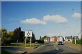
![Recent roundabout [1] in NG15 6SF](https://images.propbar.co.uk/images/geograph/53/40/5340800_120.jpg)
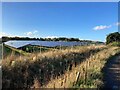
![Recent roundabout [2] in NG15 6SF](https://images.propbar.co.uk/images/geograph/53/40/5340819_120.jpg)

19 photos from this area
Area Information
Key information about the NG15 6SF including its size, population, and administrative classification.
- Area Type
- Postcode
- Area Size
- 4.8 hectares
- Population
- 1905
- Population Density
- 333 people/km²
House Prices in NG15 6SF
11
Properties
£112,125
Average Sold Price
£96,000
Lowest Price
£130,000
Highest Price
Showing 11 properties
| Address | Type | Beds | Baths | Last Sale Price | Last Sale Date | |
|---|---|---|---|---|---|---|
| 9 Starth Wood Road, Hucknall, NG15 6SF | house | - | - | £115,000 | Apr 2020 | |
| 1 Starth Wood Road, Hucknall, NG15 6SF | Semi-detached | 2 | 1 | £125,000 | Mar 2019 | |
| 3 Starth Wood Road, Hucknall, NG15 6SF | Semi-detached | 2 | 1 | £130,000 | Oct 2018 | |
| 11 Starth Wood Road, Hucknall, NG15 6SF | house | 2 | - | £103,000 | Apr 2014 | |
| 15 Starth Wood Road, Hucknall, NG15 6SF | Semi-detached | 2 | - | £96,000 | Dec 2013 | |
| 5 Starth Wood Road, Hucknall, NG15 6SF | Semi-detached | - | - | £105,000 | Dec 2006 | |
| 6 Starth Wood Road, Hucknall, NG15 6SF | Semi-detached | 3 | 1 | £122,000 | Dec 2005 | |
| 7 Starth Wood Road, Hucknall, NG15 6SF | Semi-detached | - | - | £101,000 | Jun 2005 | |
| 8 Starth Wood Road, Hucknall, NG15 6SF | house | - | - | - | - | |
| 4 Starth Wood Road, Hucknall, NG15 6SF | Semi-detached | - | - | - | - |
Page 1 of 2
Energy Efficiency in NG15 6SF
Amenities
Schools
| Rank | School | Type | Entry gender | Ages |
|---|
Explore more schools in this area
Go to Schools tabDemographics
Household Size
Two person
most common
Accommodation Type
Houses
most common
Tenure
83
majority
Ethnic Group
White
most common
Religion
N/A
most common
Household Composition
N/A
most common
Age
47
median
Adults (30-64 years)
most common
Household Deprivation
N/A
with no deprivation
NS-SEC
45
in Lower managerial occupations
Explore more demographic insights in this area
Go to Demographics tabPlanning
Planning Constraints
- Flood RiskPremium
- Ramsar Wetland SitesPremium
- Area of Outstanding Natural BeautyPremium
- Protected Nature ReservePremium
- Protected WoodlandPremium