Area Overview for NG15 6HN
Photos of NG15 6HN
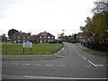
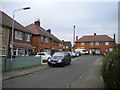
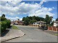
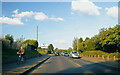
34 photos from this area
Area Information
Key information about the NG15 6HN including its size, population, and administrative classification.
- Area Type
- Postcode
- Area Size
- 1.3 hectares
- Population
- 1531
- Population Density
- 3977 people/km²
House Prices in NG15 6HN
38
Properties
£104,100
Average Sold Price
£23,000
Lowest Price
£225,000
Highest Price
Showing 38 properties
| Address | Type | Beds | Baths | Last Sale Price | Last Sale Date | |
|---|---|---|---|---|---|---|
| 44 Ruffs Drive, Hucknall, NG15 6HN | house | - | - | £187,000 | Apr 2023 | |
| 32 Ruffs Drive, Hucknall, NG15 6HN | house | - | - | £225,000 | Sep 2021 | |
| 24 Ruffs Drive, Hucknall, NG15 6HN | Semi-detached | 3 | 1 | £121,500 | Aug 2020 | |
| 36 Ruffs Drive, Hucknall, NG15 6HN | Semi-detached | 3 | - | £106,000 | Feb 2016 | |
| 28 Ruffs Drive, Hucknall, NG15 6HN | Semi-detached | - | - | £90,000 | Jan 2008 | |
| 58 Ruffs Drive, Hucknall, NG15 6HN | Flat | - | - | £56,000 | Nov 2007 | |
| 39 Ruffs Drive, Hucknall, NG15 6HN | Semi-detached | - | - | £82,400 | Dec 2006 | |
| 43 Ruffs Drive, Hucknall, NG15 6HN | house | - | - | £46,000 | Nov 2001 | |
| 33 Ruffs Drive, Hucknall, NG15 6HN | Semi-detached | - | - | £23,000 | Apr 1996 | |
| 23 Ruffs Drive, Hucknall, NG15 6HN | Bungalow | - | - | - | - |
Page 1 of 4
Energy Efficiency in NG15 6HN
Amenities
Schools
| Rank | School | Type | Entry gender | Ages |
|---|
Explore more schools in this area
Go to Schools tabDemographics
Household Size
Family (3-5 people)
most common
Accommodation Type
Houses
most common
Tenure
38
majority
Ethnic Group
White
most common
Religion
N/A
most common
Household Composition
N/A
most common
Age
47
median
Adults (30-64 years)
most common
Household Deprivation
N/A
with no deprivation
NS-SEC
15
in Lower managerial occupations
Explore more demographic insights in this area
Go to Demographics tabPlanning
Planning Constraints
- Flood RiskPremium
- Ramsar Wetland SitesPremium
- Area of Outstanding Natural BeautyPremium
- Protected Nature ReservePremium
- Protected WoodlandPremium