Area Overview for NG15 6EF
Photos of NG15 6EF
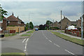
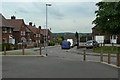
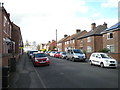
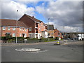
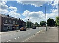
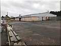
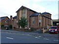
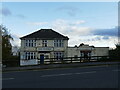
47 photos from this area
Area Information
Key information about the NG15 6EF including its size, population, and administrative classification.
- Area Type
- Postcode
- Area Size
- 1.1 hectares
- Population
- 2116
- Population Density
- 5685 people/km²
House Prices in NG15 6EF
24
Properties
£119,435
Average Sold Price
£32,500
Lowest Price
£200,000
Highest Price
Showing 24 properties
| Address | Type | Beds | Baths | Last Sale Price | Last Sale Date | |
|---|---|---|---|---|---|---|
| 40 Farleys Lane, Hucknall, NG15 6EF | Semi-detached | 2 | 1 | £148,500 | Apr 2023 | |
| 2B Farleys Lane, Hucknall, NG15 6EF | Detached | 3 | 2 | £200,000 | Jul 2022 | |
| 44 Farleys Lane, Hucknall, NG15 6EF | house | - | - | £130,000 | Aug 2021 | |
| 10 Farleys Lane, Hucknall, NG15 6EF | Semi-detached | 3 | 1 | £185,000 | Sep 2018 | |
| 16 Farleys Lane, Hucknall, NG15 6EF | Semi-detached | 3 | - | £135,000 | Nov 2014 | |
| 28 Farleys Lane, Hucknall, NG15 6EF | Semi-detached | - | - | £124,000 | Mar 2008 | |
| 2A Farleys Lane, Hucknall, NG15 6EF | house | - | - | £160,000 | Sep 2006 | |
| 14 Farleys Lane, Hucknall, NG15 6EF | Semi-detached | - | - | £163,000 | May 2006 | |
| 18 Farleys Lane, Hucknall, NG15 6EF | Semi-detached | - | - | £153,000 | Sep 2005 | |
| 32 Farleys Lane, Hucknall, NG15 6EF | Semi-detached | 3 | 1 | £119,500 | Aug 2003 |
Page 1 of 3
Energy Efficiency in NG15 6EF
Amenities
Schools
| Rank | School | Type | Entry gender | Ages |
|---|
Explore more schools in this area
Go to Schools tabDemographics
Household Size
One person
most common
Accommodation Type
Houses
most common
Tenure
57
majority
Ethnic Group
White
most common
Religion
N/A
most common
Household Composition
N/A
most common
Age
47
median
Adults (30-64 years)
most common
Household Deprivation
N/A
with no deprivation
NS-SEC
23
in Lower managerial occupations
Explore more demographic insights in this area
Go to Demographics tabPlanning
Planning Constraints
- Flood RiskPremium
- Ramsar Wetland SitesPremium
- Area of Outstanding Natural BeautyPremium
- Protected Nature ReservePremium
- Protected WoodlandPremium