Area Overview for NG14 7BH
Photos of NG14 7BH
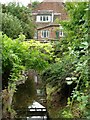
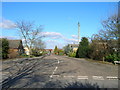
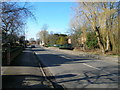

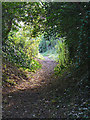


67 photos from this area
Area Information
Key information about the NG14 7BH including its size, population, and administrative classification.
- Area Type
- Postcode
- Area Size
- 5.7 hectares
- Population
- 2290
- Population Density
- 123 people/km²
House Prices in NG14 7BH
48
Properties
£153,536
Average Sold Price
£46,000
Lowest Price
£275,000
Highest Price
Showing 48 properties
| Address | Type | Beds | Baths | Last Sale Price | Last Sale Date | |
|---|---|---|---|---|---|---|
| 72 Barker Hill, Lowdham, NG14 7BH | Semi-detached | 3 | - | £205,000 | Jun 2023 | |
| 70 Barker Hill, Lowdham, NG14 7BH | Semi-detached | 3 | 1 | £222,000 | Jun 2023 | |
| 16 Barker Hill, Lowdham, NG14 7BH | Flat | 2 | 1 | £157,500 | May 2022 | |
| 60 Barker Hill, Lowdham, NG14 7BH | house | 3 | - | £275,000 | Nov 2021 | |
| 42 Barker Hill, Lowdham, NG14 7BH | Semi-detached | 3 | 1 | £200,000 | Jun 2021 | |
| 11 Barker Hill, Lowdham, NG14 7BH | house | - | - | £235,000 | Jun 2021 | |
| 44 Barker Hill, Lowdham, NG14 7BH | house | - | - | £149,000 | Feb 2020 | |
| 19 Barker Hill, Lowdham, NG14 7BH | house | 3 | - | £155,000 | Aug 2012 | |
| 34 Barker Hill, Lowdham, NG14 7BH | house | - | - | £130,000 | Jul 2010 | |
| 20 Barker Hill, Lowdham, NG14 7BH | Maisonette | 2 | 1 | £102,500 | Dec 2006 |
Page 1 of 5
Energy Efficiency in NG14 7BH
Amenities
Schools
| Rank | School | Type | Entry gender | Ages |
|---|
Explore more schools in this area
Go to Schools tabDemographics
Household Size
Two person
most common
Accommodation Type
Houses
most common
Tenure
76
majority
Ethnic Group
White
most common
Religion
N/A
most common
Household Composition
N/A
most common
Age
47
median
Adults (30-64 years)
most common
Household Deprivation
N/A
with no deprivation
NS-SEC
25
in Lower managerial occupations
Explore more demographic insights in this area
Go to Demographics tabPlanning
Planning Constraints
- Flood RiskPremium
- Ramsar Wetland SitesPremium
- Area of Outstanding Natural BeautyPremium
- Protected Nature ReservePremium
- Protected WoodlandPremium