Area Overview for NG14 7AB
Photos of NG14 7AB
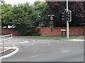
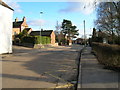
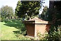
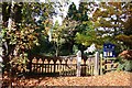
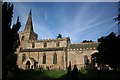

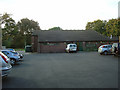
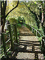
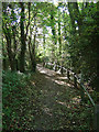
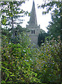

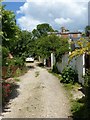
78 photos from this area
Area Information
Key information about the NG14 7AB including its size, population, and administrative classification.
- Area Type
- Postcode
- Area Size
- 1.2 hectares
- Population
- 1519
- Population Density
- 209 people/km²
House Prices in NG14 7AB
28
Properties
£206,701
Average Sold Price
£12,808
Lowest Price
£340,000
Highest Price
Showing 28 properties
| Address | Type | Beds | Baths | Last Sale Price | Last Sale Date | |
|---|---|---|---|---|---|---|
| 21 Main Street, Lowdham, NG14 7AB | house | - | - | £320,000 | Nov 2024 | |
| Rose Cottage, 13B Main Street, Lowdham, NG14 7AB | house | - | - | £235,000 | Sep 2021 | |
| 37 Main Street, Lowdham, NG14 7AB | Semi-detached | 3 | 1 | £195,000 | Jun 2021 | |
| 9 Main Street, Lowdham, NG14 7AB | Semi-detached | 5 | 2 | £298,000 | Jan 2020 | |
| The Coach House, Main Street, Lowdham, NG14 7AB | Detached | 3 | 2 | £315,000 | Oct 2019 | |
| 19 Main Street, Lowdham, NG14 7AB | house | - | - | £275,000 | Jul 2019 | |
| 43 Main Street, Lowdham, NG14 7AB | house | - | - | £171,900 | Mar 2017 | |
| April Cottage, 13A Main Street, Lowdham, NG14 7AB | house | - | - | £169,450 | Aug 2015 | |
| 11 Main Street, Lowdham, NG14 7AB | house | - | - | £340,000 | Jun 2006 | |
| 45 Main Street, Lowdham, NG14 7AB | Terraced | - | - | £128,500 | Jul 2003 |
Page 1 of 3
Energy Efficiency in NG14 7AB
Amenities
Schools
| Rank | School | Type | Entry gender | Ages |
|---|
Explore more schools in this area
Go to Schools tabDemographics
Household Size
Two person
most common
Accommodation Type
Houses
most common
Tenure
89
majority
Ethnic Group
White
most common
Religion
N/A
most common
Household Composition
N/A
most common
Age
47
median
Adults (30-64 years)
most common
Household Deprivation
N/A
with no deprivation
NS-SEC
45
in Lower managerial occupations
Explore more demographic insights in this area
Go to Demographics tabPlanning
Planning Constraints
- Flood RiskPremium
- Ramsar Wetland SitesPremium
- Area of Outstanding Natural BeautyPremium
- Protected Nature ReservePremium
- Protected WoodlandPremium