Area Overview for NG14 5DE
Photos of NG14 5DE
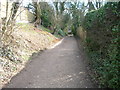
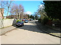
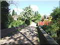
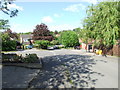
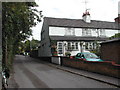
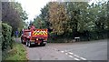
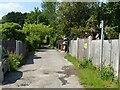
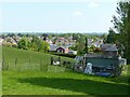
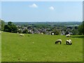
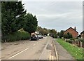
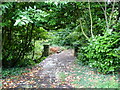
43 photos from this area
Area Information
Key information about the NG14 5DE including its size, population, and administrative classification.
- Area Type
- Postcode
- Area Size
- 5.2 hectares
- Population
- 2474
- Population Density
- 267 people/km²
House Prices in NG14 5DE
17
Properties
£383,454
Average Sold Price
£122,000
Lowest Price
£605,000
Highest Price
Showing 17 properties
| Address | Type | Beds | Baths | Last Sale Price | Last Sale Date | |
|---|---|---|---|---|---|---|
| 20 Hillcrest Gardens, Burton Joyce, NG14 5DE | Detached | - | - | £595,000 | Jun 2021 | |
| 1 Hillcrest Gardens, Burton Joyce, NG14 5DE | house | - | - | £536,000 | Jan 2021 | |
| 6 Hillcrest Gardens, Burton Joyce, NG14 5DE | Bungalow | 3 | 1 | £499,999 | Sep 2020 | |
| 10 Hillcrest Gardens, Burton Joyce, NG14 5DE | Detached | 4 | 2 | £605,000 | Aug 2020 | |
| 16 Hillcrest Gardens, Burton Joyce, NG14 5DE | Detached | 6 | 3 | £540,000 | Jun 2019 | |
| 11 Hillcrest Gardens, Burton Joyce, NG14 5DE | house | - | - | £390,000 | Dec 2017 | |
| 3 Hillcrest Gardens, Burton Joyce, NG14 5DE | house | - | - | £165,000 | Nov 2009 | |
| 7 Hillcrest Gardens, Burton Joyce, NG14 5DE | Bungalow | 4 | 2 | £310,000 | Jan 2003 | |
| 12 Hillcrest Gardens, Burton Joyce, NG14 5DE | Detached | - | - | £245,000 | Nov 2002 | |
| 22 Hillcrest Gardens, Burton Joyce, NG14 5DE | house | - | - | £210,000 | Aug 2000 |
Page 1 of 2
Energy Efficiency in NG14 5DE
Amenities
Schools
| Rank | School | Type | Entry gender | Ages |
|---|
Explore more schools in this area
Go to Schools tabDemographics
Household Size
Two person
most common
Accommodation Type
Houses
most common
Tenure
89
majority
Ethnic Group
White
most common
Religion
N/A
most common
Household Composition
N/A
most common
Age
47
median
Adults (30-64 years)
most common
Household Deprivation
N/A
with no deprivation
NS-SEC
49
in Lower managerial occupations
Explore more demographic insights in this area
Go to Demographics tabPlanning
Planning Constraints
- Flood RiskPremium
- Ramsar Wetland SitesPremium
- Area of Outstanding Natural BeautyPremium
- Protected Nature ReservePremium
- Protected WoodlandPremium