Area Overview for NG14 5AT
Photos of NG14 5AT
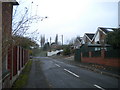
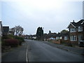
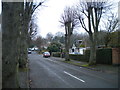
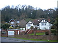
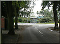
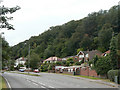
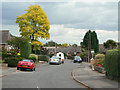

13 photos from this area
Area Information
Key information about the NG14 5AT including its size, population, and administrative classification.
- Area Type
- Postcode
- Area Size
- 1.4 hectares
- Population
- 2474
- Population Density
- 267 people/km²
House Prices in NG14 5AT
16
Properties
£199,833
Average Sold Price
£61,000
Lowest Price
£450,000
Highest Price
Showing 16 properties
| Address | Type | Beds | Baths | Last Sale Price | Last Sale Date | |
|---|---|---|---|---|---|---|
| 114 Nottingham Road, Burton Joyce, NG14 5AT | Bungalow | 2 | 1 | £250,000 | Mar 2025 | |
| 122 Nottingham Road, Burton Joyce, NG14 5AT | Bungalow | 4 | 2 | £450,000 | Feb 2025 | |
| 104 Nottingham Road, Burton Joyce, NG14 5AT | Bungalow | - | - | £250,000 | Dec 2024 | |
| 78 Nottingham Road, Burton Joyce, NG14 5AT | Bungalow | 2 | 1 | £225,000 | Apr 2017 | |
| 108 Nottingham Road, Burton Joyce, NG14 5AT | Bungalow | - | - | £186,000 | Jul 2013 | |
| 124 Nottingham Road, Burton Joyce, NG14 5AT | Bungalow | 3 | - | £237,500 | Aug 2011 | |
| 120 Nottingham Road, Burton Joyce, NG14 5AT | Bungalow | - | - | £142,500 | Sep 2009 | |
| 106 Nottingham Road, Burton Joyce, NG14 5AT | house | - | - | £195,000 | Apr 2005 | |
| 112 Nottingham Road, Burton Joyce, NG14 5AT | Detached | - | - | £150,000 | May 2003 | |
| 76 Nottingham Road, Burton Joyce, NG14 5AT | Bungalow | 2 | 2 | £180,000 | Mar 2002 |
Page 1 of 2
Energy Efficiency in NG14 5AT
Amenities
Schools
| Rank | School | Type | Entry gender | Ages |
|---|
Explore more schools in this area
Go to Schools tabDemographics
Household Size
Two person
most common
Accommodation Type
Houses
most common
Tenure
89
majority
Ethnic Group
White
most common
Religion
N/A
most common
Household Composition
N/A
most common
Age
47
median
Adults (30-64 years)
most common
Household Deprivation
N/A
with no deprivation
NS-SEC
49
in Lower managerial occupations
Explore more demographic insights in this area
Go to Demographics tabPlanning
Planning Constraints
- Flood RiskPremium
- Ramsar Wetland SitesPremium
- Area of Outstanding Natural BeautyPremium
- Protected Nature ReservePremium
- Protected WoodlandPremium