Area Overview for NG13 9JJ
Photos of NG13 9JJ
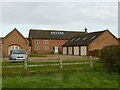
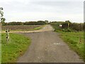
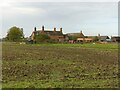
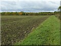
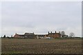
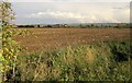
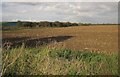
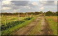
17 photos from this area
Area Information
Key information about the NG13 9JJ including its size, population, and administrative classification.
- Area Type
- Postcode
- Area Size
- 32.9 hectares
- Population
- 1318
- Population Density
- 39 people/km²
House Prices in NG13 9JJ
27
Properties
£205,797
Average Sold Price
£52,500
Lowest Price
£485,000
Highest Price
Showing 27 properties
| Address | Type | Beds | Baths | Last Sale Price | Last Sale Date | |
|---|---|---|---|---|---|---|
| 19 Works Lane, Barnstone, NG13 9JJ | Terraced | 2 | 2 | £250,000 | Jun 2025 | |
| Old Post Office, 5 Works Lane, Barnstone, NG13 9JJ | house | - | - | £425,000 | Jul 2022 | |
| 17 Works Lane, Barnstone, NG13 9JJ | Terraced | 2 | 1 | £165,000 | Mar 2021 | |
| 13 Works Lane, Barnstone, NG13 9JJ | Terraced | 2 | 2 | £165,000 | Apr 2019 | |
| Cartref, Works Lane, Barnstone, NG13 9JJ | Detached | 4 | 1 | £288,750 | Feb 2019 | |
| 11 Works Lane, Barnstone, NG13 9JJ | Terraced | 3 | 1 | £150,000 | Jul 2018 | |
| 7 Works Lane, Barnstone, NG13 9JJ | house | - | - | £245,000 | Feb 2018 | |
| 15 Works Lane, Barnstone, NG13 9JJ | Terraced | 3 | 1 | £130,000 | Jun 2017 | |
| 21 Works Lane, Barnstone, NG13 9JJ | Terraced | 2 | 1 | £125,000 | Jul 2016 | |
| 27 Works Lane, Barnstone, NG13 9JJ | Semi-detached | 2 | 1 | £190,000 | Jul 2016 |
Page 1 of 3
Energy Efficiency in NG13 9JJ
Amenities
Schools
| Rank | School | Type | Entry gender | Ages |
|---|
Explore more schools in this area
Go to Schools tabDemographics
Household Size
Two person
most common
Accommodation Type
Houses
most common
Tenure
84
majority
Ethnic Group
White
most common
Religion
N/A
most common
Household Composition
N/A
most common
Age
47
median
Adults (30-64 years)
most common
Household Deprivation
N/A
with no deprivation
NS-SEC
44
in Lower managerial occupations
Explore more demographic insights in this area
Go to Demographics tabPlanning
Planning Constraints
- Flood RiskPremium
- Ramsar Wetland SitesPremium
- Area of Outstanding Natural BeautyPremium
- Protected Nature ReservePremium
- Protected WoodlandPremium